Wednesday, May 29, 2013

Confronted by the Jersey Devil at Leeds Point

Following a moderately successful birding day on the trails at Forsythe National Wildlife Refuge this past weekend, we decided to check out some of the nearby side roads. Most people who visit Brig only go to the main portion where the visitor center and wildlife drive are... and that's fine. We wanted to see a little more.

Gotta love a healthy wetlands.
Leeds Point Road forks off of Route 9 north of Smithville and leads to other parts of the refuge, including the Scott's Landing Boat Launch. The focus there changes from wildlife viewing to duck hunting, and a rather ingenious Eagle Scout project uses a series of signs that look like birds to illustrate the permitted shooting range. Given that we're well out of hunting season, we could enjoy the sights of healthy spartina waving in the breeze without being concerned with random shots.

Binoculars always in hand, Ivan wanted to explore the stand of trees near the parking area, so in we went. We quickly felt enveloped by pitch pines, reminding us that we were, after all, in the outer reaches of the Pinelands. While blotches of sunlight shone down through hurricane-created holes in the canopy, the gnarled trees made the place feel unnatural and weird. I couldn't wait to get out.

I really don't like to make generalizations or contribute to shaggy dog stories, but we were in Leeds Point, which added a slightly mysterious undertone to the small forest. Not far from the waters of the Atlantic, the hamlet may or may not be the legendary birthplace of the Jersey Devil. Depending on which source you consult, he might have been born farther inland at Estellville, or perhaps amid a swamp along the Mullica River, which, come to think of it, is pretty much where Leeds Point is. The horned-and-winged one never seemed like much of a Shore guy, though there's a tavern called JD's in Smithville that serves a very tasty Jersey Devil burger.

Satisfied that the stand of trees wasn't very birdy at the time, we found our way back inland and turned right onto Oyster Creek Road. Just a few yards down from the intersection, we came upon this sign:

Jersey Devil sign Hidden NJ Leeds Point

Well, gee. We didn't know whether to be amused or concerned: amused for the obvious reason, concerned that we might not be welcome visitors, no matter our innocent intent. Were the locals fed up with rowdy explorers looking to raise the devil? Or were they pranking their neighbors on the next road? If they truly had negative intent, it's not likely someone would have put so much effort into an artistically-rendered three-dimensional sign. Instead, they'd have just spraypainted "Get out!" on a plank of plywood and nailed it haphazardly to a tree.

We continued driving down the road, next coming upon a creatively-executed sign advising motorists to watch for and respect motorcycle riders. Fair enough. Bikers would have enough of a challenge with the road, given the uneven, pockmarked macadam.

What we found at the end of the road was a mix of weatherbeaten Down Jersey fishing shacks and small bungalows that weren't quite as worn. Folks may live in one or two of them, but for the most part they look like shelters for weekenders who want to get a few hours sleep before jumping in their outboard-powered rowboats in the predawn hours. All they really need is space for a couple of air mattresses, indoor plumbing and a fridge for bait and beer.

Next to what looked like an old boat yard was the Oyster Creek Inn, which had attracted a sizable holiday weekend crowd. I could have sworn I'd found this place once on my own, during the depths of winter, but it was a lot livelier on a sunny spring weekend. The marsh, just north of the tract we'd seen at Scott's Landing, looked fresh and healthy. If the Jersey Devil had been born here, he'd be hard pressed to be evil. That is, until the greenheads come out in the humid languor of July.

Sunday, May 26, 2013

A home away from home: the house dorms at Douglass College

Pick any four-year college in New Jersey, and it's likely you'll find a bunch of old houses on campus, renovated for educational purposes. Some are grand, like the Guggenheim mansion that now serves as the Monmouth University Library. Others are are more modest Victorians or Colonials converted to office space as the school grew around them.

Then there are the houses that were built by schools expressly for the purpose of, well, housing students. Why would a college build a bunch of what look like one-family center-hall Colonials when they could build a big dorm instead? Good question. The story goes something like this:

When New Jersey College for Women was founded in 1918, resident students lived in the large house on George Street which is now known as College Hall. Dean Mabel Smith Douglass knew that the school would grow, so she and the board started exploring housing options for the anticipated student body. However, the search for funding to build dormitories was difficult. No lending institution would extend credit to a women's college, fearing that the school would fail to attract students and would be forced to close before paying its debts.

One bank, however, agreed to an innovative solution: build housing that litterally was houses. By constructing what was essentially a subdivision, NJC would gain a substantial number of dormitory rooms for its students. If the school defaulted on the loan, the bank would have a much easier time unloading individual houses than it would face in selling a large building.

A few of the Corwin houses on the second horseshoe.
Two residential campuses were built, both a fair distance from the college's academic buildings on George Street. Each of the campuses - now known as Gibbons and Corwin - is comprised of several houses containing at least nine bedrooms, plus a kitchenette, living room and basement study rooms. A central lodge on each campus acted as a meeting place and communal lounge. Corwin houses were built on two semi-circular roads, with larger 40-woman houses at each end of the two "horseshoes." True to the plan, each of the houses could easily be sold to private owners as cozy one-family homes, should the bank need to take possession. Each of the nine-bedroom houses had virtually identical floor plans, but the exteriors came in several varieties, just enough to add a little individuality for a potential buyer.

Renamed Douglass College in 1955, the school continued to grow and prosper, prompting the construction of more traditional dorm housing closer to the central campus. Expansion also meant that additional academic buildings were built closer to the Gibbons campus, making that housing more desirable. Corwin, on the other hand, was separated from the rest of Douglass by several Cook College buildings. While generally considered 'last resort' housing, those relegated to living in Corwin were fiercely loyal to their homes on the horseshoes. The coziness of the houses, plus the familiarity that comes from living in close quarters with 16 other students, engendered a unique kind of camaraderie among housemates.

Though the Gibbons houses are still in use as housing, Corwin stands largely vacant. A handful of the houses have served as offices for various university departments, but for the most part, the campus looks like a dated subdivision awaiting its first families to move in. Given the costs of retrofitting more than 20 houses with fire suppression systems and internet access, and the university's zeal in building new housing, it's not likely that Corwin will ever serve as dorm space again.


Thursday, May 23, 2013

Aviation history on a short runway: Lincoln Park's Ed Gorski

Hidden New Jersey has taken real or virtual visits to a lot of New Jersey airfields and historical aviation sites like Hadley Field in South Plainfield, Doolittle’s Landing in Boonton, Greenwood Lake and even the old passenger terminal at Newark Liberty International Airport. Through those visits and subsequent research, we’ve learned just how common airfields once were in New Jersey communities, and how many we’ve lost to time and real estate development pressures.

Granted, with the increase in commercial air flight, the skies are a lot more crowded than they were in the heyday of these small airstrips, but some aviation fields are still thriving. Some of the key smaller airports, like Teterboro, Morristown, Princeton and Caldwell/Essex County have evolved to handle corporate jets and the like. They’re an alternative to the major airports, especially for bigwigs who can afford to rent a private jet or own a propeller plane of their own.

Then there are the general aviation fields like Lincoln Park, which have remained largely middle-class in demeanor, with no fancy aircraft or equipment around. Those are the places that really hark back to the days when all a fixed-base operator (FBO) really needed was a wind sock, a level field and someplace to gas up the plane. Standing on the grounds, you can easily imagine that the next plane to land might be piloted by Charles Lindbergh or Wiley Post, returning from a leisurely flight over the Jersey countryside.

Back in the day, one could never know who just might be running the place. She might be an accomplished military pilot like Marjorie Gray, or, in the case of Lincoln Park, Amelia Earhart's mechanic Ed Gorski.

Ed Gorski with Amelia Earhart and mechanic
Bernt Balchen
(photo credit performancedatamanagement.com )
Actually, to simply say that Gorski worked with Earhart is ignoring his much more eventful career, in which he had a hand in the construction or maintenance of several airplanes that would later make history. He was among the first mechanics to work at what would become Teterboro Airport, helping famed aviator Clarence Chamberlin construct surplus World War I airplanes. Later, while working for Atlantic Aircraft Corp., he worked on the plane Commander Byrd flew over the North Pole, and the Fokker Friendship in which Amelia Earhart flew as the first woman to cross the Atlantic by air. He was also on the crew that built the first airplane to fly from an aircraft deck in what was envisioned as ship-to-shore airmail.

Gorski reconnected with Earhart in 1932, as she prepared to become the first woman to pilot an airplane across the Atlantic. Working with another mechanic, he reinforced Earhart's Lockheed Vega to withstand the rigors of the extended flight time and added weight of the extra fuel the craft would be required to carry. To test their handiwork, Gorski and the other mechanic logged several consecutive hours of flight time over the Meadowlands, loading the Vega with sandbags to simulate the weight of the fuel it would require for the crossing. When they were ready to return to the airport, they'd drop the sandbags where Giants Stadium now stands, leading a few observers to believe the marsh was being bombed. Gorski also accompanied Earhart to her departure site in Newfoundland to make any last minute adjustments before her historic flight.

Following his stint with Earhart's Vega, Gorski opened an FBO operation at Teterboro with his new wife Julia. Together they made a living during the depths of the Depression, providing flight lessons, running sight-seeing flights to Hackensack and back, selling airplanes and operating an aerial photography business, among other ventures. After the United States entered World War II, they moved the business to Warwick, NY and continued training pilots until Ed joined the Air Corps. Julia kept the business going as Ed flew in the Pacific theater, though wartime shortages eventually forced her to close up shop.

The Gorskis returned to New Jersey after the war, purchasing the Lincoln Park Airport in 1946. He might not have continued to make aviation history, but in many respects, Ed did much more. From all accounts, he and Julia ran a tight operation with little tolerance for cutting corners or bending the rules. In my research, I found fond remembrances from several former employees and people who'd flown in and out of Lincoln Park, recounting the lessons Ed taught them, and how he made them better, more disciplined pilots. Many mentioned his unassuming nature and their own amazement that this down-to-earth man had worked with so many aviation greats.

Both Ed and Julia were named to the New Jersey Aviation Hall of Fame in the 1970s; Ed as part of the inaugural class which included Lindbergh, Earhart and Chamberlin. While the Gorskis retired in 1979, Lincoln Park Airport continues to attract regular traffic and appears well maintained. Unlike so many of New Jersey's other historic airfields, it seems that Ed Gorski's old field will continue to welcome flyers for quite some time.


Sunday, May 19, 2013

From TVs to real estate: the story of Harrison's Two Guys

If you grew up in New Jersey in the '60s or '70s, chances are that you knew Two Guys. The retailer was the precursor to Walmart and a slew of discount department stores. Even better, actually. You could find just about anything there: groceries, toys, clothes, appliances, lumber, sporting goods, record albums and 45s... along with a snack bar and, if memory serves, a small bowling alley. I can recall the mob scene before dinner on the first day of school, with kids and moms from all over Union converging on the school supplies section for book covers, pencil cases and binders. I'm sure that a similar drama was staged at virtually every Two Guys location around the state.

The chain's "all things to all people" merchandising scheme had its roots in something more specific: scratch and dent returns in one of North Jersey's industrial centers. Back in 1946, brothers Herbert and Sidney Hubschman were running Herb's Diner across from the RCA factory in Harrison when they saw a business opportunity. RCA was one of the first manufacturers of televisions, and the Harrison plant held old floor samples and sets that had minor blemishes from shipping. I'd venture that the merchandise was equivalent to the "open box" stuff you see at appliance store clearance sales today. The equipment works perfectly well; it's just not pristine, new, in-the-box.

In any case, Sid went to RCA management to propose a deal. They'd take the sets at an agreed-upon price, pay the company for those they were able to sell within a month and return any leftovers. Given that RCA hadn't yet determined another way to dispose of the TVs, the company didn't have much to lose. They delivered the sets to a vacant lot the Hubschmans had located for the purpose, and the fun began.

Sid and Herb figured that if they sold each set for five dollars more than RCA was charging them, they'd add a nice bump to their weekly snack bar earnings. Their overhead apparently was pretty low: their salesroom (the lot) doesn't seem to have cost them much if anything, and their advertising consisted of flyers they printed up and left on the windshields of cars parked along Harrison's narrow streets.

On the sale date, the brothers were mobbed with customers. It seems that their pricing strategy had struck a sweet spot. Many RCA plant workers couldn’t afford to buy a set, even with an employee discount, and the Hubschmans “cost plus five” pricing was a much better deal, The brothers sold their month’s supply of TVs in just a few hours, and their discount appliance business was born.

That day was the beginning of a strong relationship between RCA and the brothers, so much so that local appliance retailers began calling Sid and Herb “those two bastards from Harrison.” According to local legend, the Hubschmans took pride in what would usually be an insult, and even tried to advertise using the “two bastards” phrase. (Hey, who could blame them? Their competitors would be promoting their business for free!) However, they found that no one would sell them advertising using that name, and the “Two Guys from Harrison” label was born. It was later shortened to “Two Guys,” but old customers continued to use the old name.

About a decade later, Two Guys acquired O.A. Sutton, manufacturer of the popular Vornado fan, and the retailer grew far beyond New Jersey. The brothers continued to innovate in retail, fighting for the repeal of Blue Laws that forbade the sale of clothing and some other items on the Christian Sabbath. If you’re of a certain age, you’ll recall seeing large portions of the Two Guys sales floor roped off on Sundays, despite the supermarket portion of the store being open for business. The company’s fight reached the Supreme Court in 1978, eventually knocking the laws down everywhere but in Bergen County.

Ultimately, Two Guys met its end in 1982, after parent company Vornado was acquired by Interstate Department Stores. The larger company started shutting down less profitable stores and focused on its burgeoning real estate business. Many of the properties were leased out to other discounters who, over the years, have met their own deaths. Those second generation stores have been replaced by the latest in a long line of places to buy cheap socks and who knows what else. Still, though, they're not those two guys from Harrison.


Thursday, May 16, 2013

Preakness: more than a horse race in Wayne

Every year on the third Saturday in May, thoroughbred horse racing fans watch the Preakness, the second leg of the famed Triple Crown. That's not to be confused with Preakness, the section of Wayne, but perhaps it should be.

Wayne is well known for mall shopping and sprawling suburbia, and the casual visitor would be excused for thinking that maybe some mid-20th century developer had borrowed the race name to give the area some cachet. You know, "Racetrack Estates at Preakness," or some nonsense like that. I have to admit I figured as much the first time I drove through and saw so many businesses using the label. It took some research to discover that the name, indeed, predates the both the race and European settlement in the area.

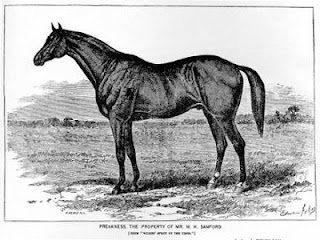
Preakness Stables was established in 1865 by Massachusetts businessman Milton Sandford, who'd made a fortune as a defense contractor during the Civil War. Like many well-heeled gentlemen, he used his riches to join the racing set, purchasing substantial acreage at what's now the corner of Valley Road and Preakness Avenue. Convenient to his New York offices and a recently built racetrack in Paterson, the land soon was the home of stables, a blacksmith shop and a three-quarter mile track. Sandford borrowed the Lenape name for the community, which has alternately been stated as "Proquales" (quail woods) or "Parekuis" (young buck), depending on the source.

The Preakness, horse racing, Wayne New Jersey, Hidden New JerseySandford also called one of his thoroughbreds Preakness, though the horse had been born elsewhere. Perhaps he was looking to build awareness of his new venture; if so his strategy was a good one. The four-legged Preakness made a stunning debut, winning the inaugural run of the Dinner Party Stakes at Pimlico in 1870. Now known as the Dixie Stakes, the race was, at the time, among the richest events of its kind in horse racing. Preakness went on to an impressive career, racing until the age of eight.

To honor the winner of its first race, the Pimlico track inaugurated the Preakness Stakes, with the first running in 1873. Interestingly, if you check out the race website, you'll find plenty of history about Pimlico, but nothing about the origin of the race name. If you happen to watch the race this Saturday, let me know if there's any mention.

Oh, and according to Wayne historians, all those sportscasters have been pronouncing the name wrong. Rather than "preek-ness," it's "preak-ness," with the first syllable rhyming with "brake."


Monday, May 13, 2013

Hiking the wilderness over Route 78

Even when you think you have a pretty good idea of what a site holds, it's always worth checking out a stray trail or two. Recently I discovered a narrow, unblazed footpath along Watchung Reservation's Surprise Lake and found my way to a whole new habitat I'd never known to be accessible. Ivan and I explored a bit farther a few days later, eventually finding the lake's marshy conclusion, hard by a sound barrier separating it from the roar of Route 78 traffic. I'd always figured that the waterway had to end somewhere; I'd just never bothered to try to get there.

It's really quite a beautiful place, if you can ignore the constant hum of interstate traffic. Choked with lilypads and wetlands grasses, the marsh is home to a number of aquatic birds, including two of my personal favorites: wood ducks and green herons. They're both fairly shy species, and our arrival caused a few to wing off to other hiding spots somewhere on the lake, but others simply swam to more secluded areas where we couldn't track them. From a wildlife viewing perspective, the place couldn't be more accommodating. Earthen berms cross the lake at two locations, allowing people (and horses in one area) to get a sense of the full length of the lake by basically standing on it. The first time around, we crossed the farthest berm out and returned to our starting point via another narrow path. It brought us up an embankment nestled against the sound barrier, the trail wandering a hundred feet or so away from but parallel to the lake's edge. Eventually we made it back to the point where I'd concluded my original exploration, and we returned to the car via the bridle path.

On our second visit this past Sunday, we discovered that the recent rains had created a stream across the start of the footpath, so we had to start our journey on the bridle path. Getting out to the berms was easy enough, and we crossed back to continue the trip. This is where we got a bit tripped up. Instead of taking the lower path that would have had us retracing our steps from the last time, we took the upper path that led uphill and closer to the sound barrier. Thing was, we didn't realize it until we were well down the path.

Route 78 bunny bridge
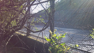
Route 78 overpass: a deer's eye view.
Something seemed a bit off. First, there was a steady stream of water coursing down the path. It wasn't troublesome, but it seemed like storm sewer water looking for level ground. The last time we were there, it hadn't rained for several days, so that wasn't a clear sign we were on the wrong path. Second, this route seemed noisier. I remembered hearing the dull roar of Route 78 traffic before, but I didn't recall it being so close. And third, the farther we got along the path, the more different the foliage was. Rather than a lot of underbrush, we had a pretty clear path through a tunnel of honeysuckle. It smelled wonderful, but still, it was a little offputting.

The noise issue seemed weird but only got stranger when I sensed the hum of traffic below us. Could we be on the famous Watchung Reservation bunny bridge?

If you're familiar with Route 78, you know that a series of bridges pass over the road in the Mountainside area. The easternmost carries Glenside Avenue across the highway, the westernmost holds an abandoned road that once led to a Nike base, and the one between them is covered with plants and trees. That wooded one is the bunny bridge, or wildlife overpass.

Why build a bridge for mammals and reptiles? The short answer is compromise. Originally, Interstate 78 was slated to run directly through Watchung Reservation, the largest plot of preserved land in Union County. Environmentalists and local residents held up construction for years, seeking an alternate route or perhaps to stop the road altogether. Meanwhile, the Federal government continued building and opening other segments of the highway, forcing travelers to find another route through the Mountainside/Summit/Springfield area.

To get the road built, government officials agreed to move the road to the edge of the Reservation and excavate a right-of-way into the Second Watchung ridge to lessen the sound impact. They also built a bridge from the main part of the Reservation to the thin sliver remaining on the westbound side of the highway, allowing wildlife to move easily between the two areas. With those elements in place, the road opened in 1986. Depending on who you talk to, the bunny bridge has been either accepted or shunned by animals.

Coincidentally, I'd recently gotten an e-mail from Hidden New Jersey reader Darian Worden, relating his own adventure on the bunny bridge. I thought we might be following his footsteps when we heard the humming traffic, but we weren't. A paved road and chain link fence joined us as we walked, raising a new discovery. I hadn't realized it, but the Glenside Avenue overpass also carries its own lane of vegetation and, presumably, the occasional mammal. We kept walking and eventually came to an athletic field where a girls' soccer league game was taking place. It was kind of like being in Field of Dreams, but without the baseball bats.

We hadn't found the bunny bridge, but something even odder (at least I think so). A view of the map shows that our path leads to additional county open space, but I'm not sure that deer are welcome there any more than they are throughout suburban New Jersey. I guess if you want to walk across Route 78 in relative safety, it's a place to do it, but you'd have to go through a bit of trouble - and mud - to do it.

(Incidentally, if you'd like to check out Darian's account and photos of the bunny bridge, surf on over to Head First Adventures.)

Friday, May 10, 2013

Ghosts of Turnpike service areas, silent on the Newark Bay Extension

Drive eastbound on the Turnpike's Newark Bay extension, and as you approach Exit 14B for Liberty State Park, you might notice the road widens somewhat briefly on both sides. It's almost as if the road's a big snake that's swallowed a mouse but hasn't yet digested it. In recent years, the widenings have been filled with construction equipment and materials for the construction work being done on the Vincent Casciano Bridge over Newark Bay. Every time I pass them, I get this nagging feeling that the spots were once small service areas many, many years ago.

Turns out they were.

Details are rather scant, but it seems that the pair were named for John Stevens (eastbound) and Peter Stuyvesant (westbound), two personalities with connections to the Hudson County area.

Stevens, of course, is the name of a notable early New Jersey family with roots in Perth Amboy. The first famous John Stevens was born in 1715 and served in the Continental Congress. His son John was as an officer in the Continental Army and later did duty as state treasurer. The younger man's greater fame, however, came through his contributions to transportation, particularly using steam power. His craft Phoenix became the first steamship to sail the open ocean when it traveled from Hoboken to Philadelphia in 1809. More famously, he established the first steam ferry service between Hoboken and New York City in 1811.

A few years later, Stevens and several partners were awarded the nation's first railroad charter, establishing the New Jersey Railroad. Predictably, he experimented with steam-driven trains at his Castle Point estate in Hoboken. After his death, the property passed to his son Edwin, who later bequeathed the land and a million dollars for establishment of an institution of learning, now Stevens Institute of Technology.

Peter Stuyvesant, well, he's probably a bit better known, but more commonly associated with New York. In the days when the Dutch West Indies Company ran Manhattan and surrounding areas as a business, Stuyvesant was sent to essentially clean house as director general of New Netherlands. His immediate predecessors had both mismanaged the colony and turned a blind eye toward some rather, well, permissive behavior.

Stuyvesant's tenure was a mixed bag. On the positive side, he negotiated disputes with the Lenape, fostered education and is credited with many reforms that encouraged a more family-oriented environment in the colony. Unfortunately, he also squelched religious freedom in a community that had long advocated tolerance; his actions against houses of worship other than the Dutch Reformed Church were ultimately rescinded by Dutch West Indies Company directors.

I was a bit confused as to why he warranted a Turnpike service area, until I read that he opened the land west of Manhattan for settlement. Some consider him to be a founder of Jersey City, crediting him with overseeing the formation of the village of Bergen, now the location of the city's Bergen Square.

Back on the Turnpike, the Stevens and Stuyvesant service areas were closed in the early 1970s. I haven't uncovered a reason why, but I'd conjecture that they were either too small or too disruptive to the flow of traffic rushing toward or from the Holland Tunnel. Drivers can get their last (or first) taste of lower-priced New Jersey gasoline closer to the Tunnel, so perhaps the Turnpike options were priced out of existence in during the oil crisis of 1973. Your guess is as good as mine.


Tuesday, May 7, 2013

Gone fission: Discovering uranium near the D&R Canal

Over the years, we've found a lot of old mines in our travels around the state, so much so that they barely seem worthy of mention anymore. Iron, zinc and copper, especially in the northwestern portion of the state, were fairly commonly found and mined extensively until cheaper sources were found in the Midwest.

But uranium? That was a new one on me.

Ivan and I were departing Bulls Island after a warbler-finding excursion the other day when he spied a sign on the opposite side of Route 29 from the park entrance. "Uranium ore," it said. "Found here in 1956 near Raven Rock. Mining company formed by prospectors responding to the cold war craze was never commercially viable."

We've come to expect that two sentences on a Hunterdon County historical marker will lead to a much more involved story (see Liver Eating Johnson), and it appears that the uranium mention follows suit. According to a 1956 United Press story, brothers Alvin and Vernon Gatling claimed to have found a rich supply of the mineral element near Route 29, stating that samples from their 400 acre claim contained at least 2 percent and as high as 7 percent raw uranium. Their lawyer, a former federal prosecutor, said that the brothers were licensed by the U.S. Atomic Energy Commission, which had confirmed the uranium content.

So... if that's the case, what happened to the mine? Why is the historical marker the only sign of anything to do with uranium? Had locals protested the inevitable scarring of the beautiful landscape? Did the brothers dissolve their business after a dispute? And why, when I checked all my usual sources, could I find no mention of uranium mining in New Jersey, the Gatling brothers, or, for the most part, Raven Rock?

I had to do a bit of digging to get the answer, and it turns out that timing worked in my favor. Local historian Bill Saja tells the story in the recently published anthology Stories from Raven Rock New Jersey.

Actually, the first sign I found that something was off was the description of the Gatlings in the newspaper story, in which Vernon claimed they were "graduates of the New York Public Library school of geology" and had spent six months working in Colorado uranium mines. I'm obviously a big fan of personal study, but when radioactive elements are concerned, I'll stick with the traditionally trained scientists, thank you. Saja's account led more credence to the gut feeling that things were not completely legit with the Gatlings. They were college educated --Vernon a law student and Alvin having two years undergraduate study -- but not in the sciences. Rather, they seemed to want to cash in on the uranium craze that had hit the U.S. with the advent of nuclear fission as a clean, viable power source.

It all started when the brothers stopped by the old Raven Rock stone quarry and asked its owner, Anton Schuck, if they could check it out with their Geiger counter. Figuring they were just harmlessly exploring as so many other hobbyists were at the time, he gave them permission to go on the property. When they came back a few months later to ask if they could do some test borings, he allowed them in again. He even let them use his garage to store the results, which they said indicated the property held little uranium.

Thing was, they weren't entirely truthful with Schuck, which he discovered when they returned to the quarry and began drilling an access shaft without his permission. The brothers had been busy during the intervening weeks, filing a lease for the property at the Hunterdon County courthouse. Despite the fact they hadn't gotten Schuck's signature or permission to use the land, they felt they had standing, based, probably, on their find.

While Schuck fought to get the aspiring miners off his property, Raven Rock and its environs became the center of attention for the media and curiosity seekers. The aspiring tycoons were busy selling stock in the Gatling Brothers Mining and Development Company, based on the growing estimation of the value of the uranium they'd extract. Some of their contractors and attorneys agreed to take payment in the form of equity; family and friends were eager to buy in at 25 cents per share. Apparently the brothers themselves were as taken in by their dreams as their other investors were, spending their anticipated riches before seeing any marketable product from the mine.

Inevitably, the entire situation ended up in the courts for a variety of reasons, the Gatlings' claim on Schuck's land being just one. With limited funds and no income from the mine, the brothers simply couldn't pay their bills, leading to accusations they were intentionally writing bad checks. The federal Securities and Exchange Commission was investigating them for improperly issuing stock to investors. And several lawyers refused to represent them, claiming that the brothers wouldn't listen to sound counsel. Meanwhile, the mine site lay fallow, nature taking back what man had disturbed.

The whole thing was finished for good in 1963, after the Gatlings filed a suit against Schuck for damages and mineral rights. As a compromise, the brothers agreed to secure an expert who could confirm the presence of valuable uranium on the land, but they never followed through. In his judgement to dismiss the case with prejudice against the brothers, the presiding judge said, "this matter has been adjourned six times, four times at the request of counsel of the plaintiffs, and two times when counsel for the plaintiffs did not appear." I'd say the courts saw the whole thing as a nuisance instigated by two very misguided men.

It's that lack of sense that makes it all so puzzling. The brothers clearly weren't con men: they ended up just as damaged as the people who'd invested time and treasure in their scheme. Saja raises a possible clue in his account: less than a month before the brothers filed incorporation papers for their mining venture, Alvin had been released from a six-week stay at Marlboro State Psychiatric Hospital. Whether Alvin's mental state played a role in their poor business decisions or not is up for conjecture. From what I can gather, they'd formed an enterprise in search of a mine, and the Raven Rock quarry appeared as good a place as any.


Saturday, May 4, 2013

On the (Sandy) Hook again

It seems a little weird to compare the reopening of Sandy Hook to Christmas, but in my case, it works. It's long been the place where I can go to get some peace, and it's one of the spots on Earth that just make me feel good without even trying. Even in the dead of winter, I can usually find a good adventure or, with Ivan, an interesting feathered visitor.

Anyway, May 1 has been on my calendar as the official reopening date for the Hook post-Hurricane Sandy, and I couldn't wait. I woke up sometime around 4:30 a.m. and couldn't get back to sleep, so I opted to make an early start. Sunrise was at 5:55, giving me plenty of time do all my morning stuff and hit the highway by daybreak.

The Park Service has done a great job of setting expectations on restoration through their Facebook page, but I didn't know what to expect in terms of visitation. Weather already looked wonderful, making it as good a day as any to play hooky from work, at least for the morning. Would there be a crowd?

When it came to birds, it was anyone's guess. Since nobody's been birding there all spring (or just hasn't reported, if some lucky duck got access), it's hard to know whether the storm's impact has changed the place enough to make it unattractive to some species and more attractive to others.

Whatever the case, I was eager to get there and find out for myself. As I took the Route 36 bridge over the Navesink River, I couldn't help but let out a whoop of happiness. I can recall having that kind of happiness entering the park on a beautiful summer morning, or at any other time of the year when I needed to recharge my batteries with a day on the Hook. I didn't realize how much I missed it, though, until I drove through the entrance plaza and my eyes teared up. Roads are still rough in places (they've been milled and some are yet to be repaved), but knowing they'd been covered with sand, I was happy they were entirely passable. And it seemed that I'd gotten there before just about everyone but the fishermen.

The landscapers have come!
Battery Peck hasn't looked this good in a long time.
My plan was to make my way to the warbler trail next to Battery Peck and Nine Gun near the tip of the Hook, and then check out some other birding spots along with Fort Hancock. Given the time of year, it seemed like the best approach.

Except that it wasn't. I neither saw nor heard a single warbler in the tight foliage along the path, though plenty of red-winged blackbirds and robins were around. Perhaps, I thought, the warblers were waiting for their breakfast bugs to warm up in the early morning sun. Either that, or they'd already come and gone.
The worst of the damaged porches on Officers Row.

On the way to my next stop, the scout camping grounds, I wound my way around Fort Hancock. I happily found a pair of osprey making a cozy home atop the Officers' Club chimney, and several others on the wing. The park's closure meant I couldn't make my usual mid-March visit to check on their annual return, and I was glad to see so many nesting around the Hook. Maybe they weren't as plentiful as blackbirds, but for a few minutes they certainly seemed to be.

Overall, as I drove around, I saw that many of the buildings had taken at least a small hit from the storm, from busted windows to missing roof shingles. Probably the worst I saw was the old mule barns near the Coast Guard base, which were accessible only by boat for a few weeks after the storm. Most of the Officers' Row houses now suffer the indignity of propped-up porch roofs and missing front and/or back steps, though it also appears that the stabilization boarding over the windows is new. The brick work all seems to have held up: those structures were built to last.

There's nothing like new barbecue equipment!
The scout camp, when I got there, was a tiny bit more productive from a birding perspective. In fact, it was tea time according to the most prevalent song birds there. The call of the normally delightful Eastern towhee has been described as "drink your teaaaaaa," but most of these guys simply sang the last two notes. They had me hunting for a bit, until one handsome fella perched atop a shrub, singing for all to see in the bright morning light. He was just the first of many who made themselves visible on my rounds. Perhaps a flight had come in overnight, or maybe procurement sent the Park Service towhees instead of warblers, but I hadn't seen so many in one place ever.

The boardwalk and deck
on Spermaceti Cove
were removed by the hurricane.
Still, though, I was a bit frustrated by the seeming lack of avian diversity, and as I ran into other birders, they admitted being just as disappointed. Walking the multi-use path will often reveal a wide range of birds, but the only ones who'd show themselves were annoyed house wrens and a pair of house finches. The lighting, however, was fantastic, illuminating the iridescence of a grackle as I'd never seen before. Absolutely gorgeous!

I also walked the maintenance road and bayside beach near Batteries Kingman and Mills, finding more towhees in the brush and a gathering of late-staying brant and a merganser in the water. Without realizing it, I antagonized a pair of osprey nesting on the land side of Kingman, an area I hadn't known was equipped with a platform for them. They seemed to be doing much better than the less-than-wise pair who were building a nest on a utility pole next to the road.

It'll probably take some time to determine the impact the hurricane has had on the flora and, by extension, the birds' feeding opportunities on the Hook. As I was reminded by one of the friendly NPS maintenance people I ran into, the peninsula had been hit with 13 foot storm surges, and the resulting flooding had to have made its mark.

For the time being, there are still repairs to be made. Superficially, there's road repaving and reconstruction of wooden walkways, most remarkably the boardwalk and observation deck at Spermaceti Cove, now totally gone. Long term, the park still needs major infrastructure improvements, including the sanitary sewer system. If you're planning a trip there, consider stopping by the Wawa or Quick Chek on 36 as you approach the park. The porta-johns were very clean when I checked, but, well, why go rustic if you don't have to? In any case, it's a small inconvenience when compared to the joy of being back on the Hook.


Wednesday, May 1, 2013

The Battle of Chestnut Neck: Atlantic County's Revolutionary War saga

I've got a warm spot in my heart for communities that make an effort to commemorate their otherwise little-known places in history. Having grown up in Union, I'll explain the significance of the 1780 Battle of Connecticut Farms for anyone who will stand still for five minutes. Thus, I was in my element when Ivan and I stopped to check out the imposingly tall monument on Route 9 north of Forsythe NWR.

Bordered by roads on all three sides, the monument seems vaguely off. First, it seems to be in the middle of nowhere, though it's a short drive from the Parkway. Second, the statue of the Revolutionary War-era soldier on top is facing out to sea. It's definitely not placed to attract a ton of visitors, but as we discovered, there's good reason.

We'd stumbled onto the site of the only Revolutionary War battle to take place on the South Jersey shoreline. Memorializing the 1778 Battle of Chestnut Neck, the monument was erected by the Daughters of the American Revolution a little over a century ago. After we parked the car, we discovered even more: a British anchor and a smaller memorial, plus a very informative set of postings from the local Sons of the American Revolution.

To understand the strategic importance of Chestnut Neck, you need to know a little about the naval resources of the Continental forces during the battle for independence. Plainly put, they weren't much. Conversely, the British Navy was considered to be the finest in the world at the time. To improve the odds, the Continental Congress enacted a privateer system by which private merchant vessels were commissioned to capture British supply ships, bring them to port and unload their cargo. Not only would the British fighting forces lose valuable supplies, but the cargo would be sold and proceeds split among the American captains, crew and government. You could say the British were hoisted by their own petard: they'd successfully used the same strategy against the French in an earlier dispute.

A map near the monument
illustrates the terrain and location
of the Chestnut Neck fort.
In Southern New Jersey, the Great and Little Egg Harbor Rivers played crucial roles in this new economy, hosting warehouses and markets for the plundered British cargo. Chestnut Neck stood at the mouth of the Little Egg, and residents built a protective fort in 1777, funded by the New Jersey Assembly. It appears, however, that the budget never accounted for guns. Regardless, the port prospered as a privateer base, hosting the sale of about 30 ships and their cargo.

That kind of success naturally made Chestnut Neck a target of British ire. From their base in New York, General Clinton and Admiral Gambiel determined that the privateers and their cohorts had to be stopped. Nearby Batsto Ironworks was accessible by the Great Egg Harbor River and deemed a worthy target while they were in the area; ending production there would severely hamper the Continentals' weapons supply.

After departing Manhattan on September 30, 1778, the British ships' arrival was pushed back due to harsh weather, giving the Americans a chance to learn about the plot and move many of their ships safety at sea or farther up the river. Nonetheless, when the British reached Chestnut Neck on October 5, local loyalists updated them on militia plans and activities.

This more recent monument
honors privateer captains.
The next day saw the bulk of the action. While the British fleet had difficulty navigating through the shallow waters of Little Egg Harbor River, they managed to make it to Chestnut Neck, which was largely undefended. The remaining ten ships under colonist control were dismantled and burned, along with the fort and the rest of the community. According to contemporary reports, the fires persisted well into the next day.

While the British may have destroyed Chestnut Neck, they thought better of continuing on to Batsto to complete their mission. The fact that many of their craft were becoming grounded in the shallows, combined with the knowledge that the Americans were on to their plans, was enough to encourage them to withdraw.

Still, the British raid had permanently wiped Chestnut Neck off the map as an organized community. Residents resettled at nearby Port Republic, though there's now a relatively small area with a few houses and several boat ramps for small craft. And, of course, there's the monument. If you're in the area, just take Parkway exit 48 to Route 9 south and keep an eye toward the East. You'll find it pretty quickly.