Deep in the heart of New Jersey is a community constructed in whole cloth, so to speak, by the Federal government during the Great Depression. Originally founded as Jersey Homesteads within the larger community of Millstone Township, the borough is now known as Roosevelt. It's also the only complete town to be listed on both the state and national historic registers.
Under the aegis of the U.S. Department of the Interior Subsistence Homesteads program, nearly two square miles of Monmouth County farmland became an agricultural and industrial cooperative community for unemployed Jewish garment workers seeking to leave overcrowded Manhattan living conditions. Russian immigrant and community founder Benjamin Brown envisioned a place where Jewish culture would be preserved. In fact, the records of many of the early town meetings were kept in Yiddish.
Like many other planned communities, Jersey Homesteads was laid out functionally, with clusters of houses on half acre lots, surrounded by common open space. All were designed in the Bauhaus style that was in the vogue in Europe at the time: single story concrete-and-steel buildings with little if any ornamentation. You can imagine that these living quarters were quite different from what the Homesteads residents were accustomed to on the Lower East Side.
The farm experiment didn't work out too well, as most of the settlers had little experience working the land, and the collectively owned and operated garment factory ultimately met a similar fate. However, the community became a haven for artists and intellectuals from the very beginning. Noted artist Ben Shahn moved to town in 1937 and left his mark most notably with a huge fresco mural in the Roosevelt public school building, depicting immigration history and labor reforms. These days, artists and non-polluting businesses occupy the old factory, and Roosevelt's population is one of the most highly educated in the state.
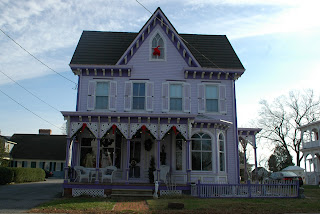
On my visit one Saturday, Roosevelt was quiet, leaving me to drive around town slowly to get a glimpse of what had become of the original structures and town design. What I saw was a mix of the old Bauhaus along with some more recent construction, all pretty much remaining in the envisioned peaceful environment.
The public buildings are all basically gathered in the same place: the post office, deli and grade school are clustered on one street, while town hall is just down the road. I stopped by the school to see if I could get a glimpse of the Shahn mural, but it was out of view. What I found instead was both fascinating and a little weird.
There's a small outdoor amphitheater next to the school, with a prominent bust of Franklin Delano Roosevelt. Actually, it's not a bust in the traditional sense. It's more like a Roosevelt head mounted on a square column on which his name is chiseled. It's a decent enough likeness, but there's something about it that seems, well, kinda weird. Surrounded by benches as it is, and bereft of an actual body (which, given the size of the head would be darn imposing), it's almost supernatural, as if there's one night of the year when people gather to receive messages from it or something. That's not to say that there's anything strange going on there. It just struck me odd.
Read the town's website or talk to any of its residents, and it becomes very clear that this is a close-knit community with a civic consciousness and pride in its origins. The homes may be modest and the amenities in town are very limited, but Roosevelt remains a desired address for cultured types. Just remember that you have to pick up your mail at the post office.
The travels and adventures of a couple of nuts wandering around New Jersey, looking for history, birds and other stuff.
Saturday, December 31, 2011
Wednesday, December 28, 2011
Stamps, express mail and works of art
How often do you find yourself going to the post office lately? If you're like me, it's a fairly rare occurrence, especially now that I do most of my correspondence and bill paying electronically. Mostly, I'm there to ship something I sold on eBay, or maybe I'm sending hard-copy writing samples via express mail.
I have to admit that when I have time to spare, I rather enjoy going to the post office in my small town. It's old-timey and maintains that feeling of permanence you want in a government building, which so many newer buildings lack. Take a look at the higher reaches inside the lobby area of an older post office, and chances are you'll see some vintage murals. Depending on the location, you might see colonial history, idyllic local scenery, or maybe heroic representations of New Jersey industry.
These murals were the product of a convergence of economic hardship, government stimulus and artistic trends in the 1930s. Art - and artists - tend to suffer in poor economies, and the Great Depression was no exception. Among the 'alphabet soup' bureaus created under the Roosevelt Administration were the Federal Art Project, Public Works of Art Project and the Treasury Department Section of Painting and Sculpture, all designed to provide work opportunities to artists while improving public buildings. Murals were particularly popular, as the Italian Renaissance fresco style had come to the fore during the Roaring 20s. Most showed more traditional styles, idealizing American values in the communities where they were housed. They didn't just put the unemployed to work, they help to tell the stories of our past and expose us to fine art at the same time. Nationally, more than 5000 jobs were created through the art programs. In New Jersey alone, nearly 50 post offices were graced with their work.
I do wonder about the veracity of some of the scenes, though. The recently-restored mural at the Cranford Post Office, for example, is purported to depict the Battle of Cranford, a skirmish I've yet to hear of. Yes, troops were cantoned along the Rahway River in the town, but it's not likely they actually fought on town soil. I'm sure the mural has built community pride in our colonial forebears, perhaps it's at the price of accuracy.
These days, the murals have likely lost their meaning for many people who see them, but they're worth a look. When they were first installed, they showed a vision of the best of a prosperous and hopeful America. Today, they show the optimism of a people in the depths of economic despair, a people who would enjoy a level of prosperity within a generation.
Sunday, December 25, 2011
Was Santa Claus born in Morristown?
Today, as many New Jersey children awake to the delight of toys around the Christmas tree, my own thoughts return to the excitement I felt for the visit that Saint Nick would make to my house.
Little did I know that the red-jacketed, white-fluffy-bearded big guy with the bag full of goodies is actually from Morristown.
Well, kind of.
It's no secret that our concept of Santa Claus was cemented in the public eye by political cartoonist Thomas Nast. Few people realize that Nast lived in Morristown for many years, on Macculloch Avenue.
Like many New Jerseyans today, Nast was a transplant. Born in Germany, he and his family moved to New York when he was a child, and it was there that he became famous for his politically-inspired drawings. This was before the large-scale use of photography, and good illustrators were essential for magazines to cover the stories of the day. Early in his career, he covered the wars in Italy for publications in New York and London, which made him the logical choice to cover the Civil War for Harper's Weekly.
He was a noted voice railing against the corruption of the Boss Tweed political machine that ruled the city after the Civil War, so much so that Tweed's representatives attempted to bribe him to leave the country. Instead, Nast moved his family to Morristown in 1872 and commuted to New York to continue his work at Harpers. His unrelenting attacks so infuriated the electorate that Tweed and his crew were voted out of office, with Tweed eventually convicted and sent to prison.
While crusading for what he felt was right and fair, Nast drew likenesses that have become ingrained in American culture: Uncle Sam, the Democratic and Republican mascots, and, of course, Santa Claus.
Nast's house is privately owned and not open for tours, but the nearby Macculloch Hall Historical Museum maintains the nation's largest collection of his works. Contributed by his family, the Nast archive includes rough sketches, watercolor and oil paintings, and proofs and drawings in pencil and ink. Students of the artist can also make an appointment to view his personal papers and photos.
I'm still trying to figure out whether Nast actually lived in Morristown when he drew Santa for the first time, but I'm not sure it really matters. Like many other notable people we New Jerseyans claim as our own, he lived here for a bit, and that's good enough for me.
Thursday, December 22, 2011
Ducks, Barnegat Lighthouse and the Civil War
"What are three things that have never been in my kitchen?" (Apologies to Alex Trebek and legions of Cheers fans. Sorry, couldn't help it.)
The cold weather brings duck season with it. No, I don't mean the Looney Tunes/Merrie Melodies kind of duck season, wabbit season, Elmer season. I mean the "Wow, did you ever know that so many kinds of ducks come to New Jersey?"
I first discovered this on a solo winter trip to Long Beach Island several years ago. Walking on the jetty by the lighthouse, I noticed some beautiful black, white, gray and rust-colored ducks congregating in the waters next to the rocks. Their colors seemed to be applied in blocks, much as one might work a paint-by-numbers portrait. I didn't know at the time, but harlequin ducks can often be found there in the winter, right along the rip-rap that protects the lighthouse property from eroding into the bay. They're a nice diversion from the mallards we're all familiar with.
Ivan and I visited Barnegat Light State Park last January to see these and other ducks, but before we got to the jetty, he wanted to stop and pay his respects to George Meade. Huh?
Turns out that the designer of the Barnegat Lighthouse is none other than the man who led the Army of the Potomac to victory at Gettysburg and several other Civil War campaigns. Meade was both an army officer and civil engineer who specialized in coastal construction. It was logical, then, that he was the one who designed the successor to the original 40-foot Barnegat light, which had been shoddily built in 1835.
Meade's replacement stands a majestic 172 feet, second in height to only Cape Hatteras light on the entire east coast. He used an innovative cylinder-inside-cone design that provides moisture-blocking insulation between the tower's inner and outer walls. While the construction has held strong since the light was first illuminated in 1859, the biggest threat to the tower is erosion to the north end of Long Beach Island, where it stands. That's why the rip rap is there, creating a harlequin-friendly environment not far away.
Meade also designed Cape May and Absecon Lights, both of which tower around the 170 foot mark. Depending on who you talk to, you'll hear differing opinions on which is tallest, or which should be considered most challenging in number of interior steps, but all have largely withstood the test of time. To my knowledge, Barnegat is the only light that commemorates Meade with a bust or plaque. Personally, I think the best homage to him is to climb to the top of his creation, look out to sea and imagine all of the mariners whom it guided safely to port.
Labels:
Barnegat,
Civil War,
harlequin duck,
LBI,
lighthouse,
Ocean County
Location:
Barnegat Light, NJ, USA
Monday, December 19, 2011
East Point Lighthouse: at the end of New Jersey
To many people, the 'end' of New Jersey is Cape May Point, punctuated by the lighthouse.
To me, it's East Point, in Heislerville, also punctuated by a lighthouse.
Cape May is nice and all, but there are way too many people for it to be the 'end.' The end, to me, is a place where everything stops, and it's just you, nature and a broad expanse of water with no indication of land on the other side.
I first found East Point during a New Jersey Lighthouse Society Lighthouse Challenge Weekend. Held every October, these events encourage people to visit all of the open lighthouses in the state. The year I did it, that meant 11 structures that ring the coast starting at Paulsboro at the Delaware River and curving around the lower contours of the state and upward till you get to Sandy Hook at the mouth of the Raritan Bay. Starting on the river side, I visited two sites and was debating the third, which was a good 90 minute drive away near the mouth of the Maurice River.
That third lighthouse was East Point, a bit of coastal New England on the shores of Delaware Bay.
I was absolutely transfixed on that first visit, even with dozens of people present. East Point is the true middle of nowhere, and it's very easy to stand among the surrounding reeds and the wind, and consider this the edge of the earth. Imagine being the lighthouse keeper there, back in the day when Down Jersey was even more remote than it is today.
East Point began service in 1849 and is the second only to Sandy Hook in age among New Jersey lighthouses. Unlike most of the state's navigational beacons, it's a true house with a light on top, rather than a tower and lantern. It operated until the start of World War II, when it was extinguished for defensive purposes. Rather than relighting after the war, the Coast Guard deeded the building to the state, whose neglect doomed East Point to damage from the elements and vandalism.
Fast forward to the early 1970s, and a group of local residents banded together to save and restore the lighthouse. The Maurice River Historical Society has been working to bring East Point back to life, slowly but surely, first replacing the roof and lantern room and then successfully petitioning the Coast Guard to reinstate it as an active navigational aid.
I've visited the lantern room a handful of times during open houses, which generally are held on the third Saturday of each month during the spring, summer and early fall. It's been a while so I'm not certain how far the interior restoration has gotten, but on my most recent visit I was happy to see they'd gotten matching grants to continue their work.
In a way, though, it doesn't matter that much to me. Don't get me wrong: I'm all for bringing East Point back to its former glory. I just don't go there to see a perfect lighthouse. I go there for the atmosphere. It's the perfect place to contemplate life.
The more populated places in New Jersey don't offer a lot of opportunity for introspection. Before you can even start an interior dialogue, you have to block out all of the distractions, and that can be a mammoth challenge. At East Point, you're left with your thoughts, or perhaps with a close friend if you'd like. There's nothing getting in the way, except maybe a fisherman who's just as intent on solitude as you are. I didn't check, but I wouldn't be surprised if cellular service didn't reach that far.
Sunsets are beautiful there, as I'm sure sunrises are, too. Horseshoe crabs clamor next to the small boat launch in the spring to lay their eggs, and Monarch butterflies stop by for sustenance and a rest in the fall. The phragmites turn with the season, and the tide goes in and out. The rhythms of the natural world take over, and bring you with them.
Location:
10 Lighthouse Rd, Port Norris, NJ, USA
Saturday, December 17, 2011
Only slightly clammy: the towns of Bivalve and Shellpile
If you're sick of congestion and crowds and noise, have I got the place for you!
Years ago I found Shellpile and Bivalve, twin communities in the larger community of Port Norris, which is, in turn, part of the even bigger Commercial Township. These mollusk-themed places share a common link to the fortunes and downfall of New Jersey's oystering heritage.
You read that right: New Jersey and oysters. It's not widely known now, but in the first half of the 20th century, Delaware Bay was home to an abundant oyster population and a significant fishing industry to capitalize on it. A vibrant business community settled in Shellpile and Bivalve to harvest and process oysters, shipping them in long freight trains to markets in New York and Philadelphia. The name Shellpile, in fact, refers to the vast mountains of oyster shells dumped outside the processors' factories. Thousands of people lived nearby, mostly in sub-standard housing, filling the demand for labor at all stages of the oystering process.
A lethal parasite called MSX (Multinucleated Sphere Unknown) decimated the region's oyster population in the late 1950s, taking the fates of Shellpile and Bivalve with it. Today, a few companies continue to process clams and oysters brought in from other areas, but for the most part, the community has taken on a ghost town-like aura. The only time it livens up is for the annual Bay Day in June.
To get to Shellpile or Bivalve, you first need to drive through Port Norris, an experience straight out of a Twilight Zone episode. The streets are lined with homes and the occasional business or government building, but rarely is there a soul to be seen. The place doesn't look especially well-off, though it's definitely liveable. Where is everyone?
I wasn't sure what to expect when I visited recently. It had been a while since I was down there, so I didn't know if some of the structures I knew would be gone, but I was pretty well assured nothing would have improved. I'm still hurting from the time I visited to find that the fabled Shellpile Restaurant had been sold. I didn't have the heart to go inside and find out whether the owner had sold his out-of-this-world crabcake recipe along with the building.
On this visit, I was pleasantly surprised to see a big red, white and blue banner flapping in the breeze near the waterfront, welcoming visitors. The Bayshore Discovery Project had restored one of the historic shipping sheds, and it was actually open for visitation. When I went inside, two women were engaged in a meeting, busily talking about an upcoming event to be held there.
The Bayshore Project people have been in Bivalve for years, as it's the home port for the official New Jersey state schooner, A.J. Meerwald. Formed in the late 80's, the Project organization is responsible for the restoration and upkeep of the Meerwald and use it for a variety of educational purposes. Their larger goal is to motivate people to take care of the environment, the history and culture of New Jersey's Bayshore Region through education, preservation and example. During the summer, the Meerwald offers sailing excursions and summer camps to give kids and adults alike the opportunity to see what life was like on an oyster schooner in years past.
Unfortunately, the museum exhibit was closed during my visit, but I wandered through the building and outside a bit to find signs that it's probably pretty active during the warmer months. They even have a raw bar set up, which is enough to get me to return.
Outside of the immediate wharf area, Bivalve was very very quiet, looking, as always, like a painting Edward Hopper might have done during a period of severe depression. Old boats up on blocks had obviously not felt salt water lapping their hulls in many a year, and the church building was as shut-up and abandoned as it had been when I first saw it over a decade ago.
I took the narrow road through fields of phragmites to check out the Shellpile waterfront and found the same, if not more so. Summertime near the old Shellpile Restaurant is often more active, given the boat launch nearby, but on a Saturday in December, there wasn't much more than a few turkey vultures and a flock of gulls picking through a small pile of clam shells. When I first started visiting the area, I found it eerie. Now I find it curiously calming. Yeah, there's the possibility of a random visitor or resident driving by, but I've never been questioned or confronted by anyone when I was there. Somebody would actually have to be around for that to happen, and it often feels as if I'm the only human being within miles.
Years ago I found Shellpile and Bivalve, twin communities in the larger community of Port Norris, which is, in turn, part of the even bigger Commercial Township. These mollusk-themed places share a common link to the fortunes and downfall of New Jersey's oystering heritage.
It just looks as if these boats are sailing on shells. |
A lethal parasite called MSX (Multinucleated Sphere Unknown) decimated the region's oyster population in the late 1950s, taking the fates of Shellpile and Bivalve with it. Today, a few companies continue to process clams and oysters brought in from other areas, but for the most part, the community has taken on a ghost town-like aura. The only time it livens up is for the annual Bay Day in June.
To get to Shellpile or Bivalve, you first need to drive through Port Norris, an experience straight out of a Twilight Zone episode. The streets are lined with homes and the occasional business or government building, but rarely is there a soul to be seen. The place doesn't look especially well-off, though it's definitely liveable. Where is everyone?
I wasn't sure what to expect when I visited recently. It had been a while since I was down there, so I didn't know if some of the structures I knew would be gone, but I was pretty well assured nothing would have improved. I'm still hurting from the time I visited to find that the fabled Shellpile Restaurant had been sold. I didn't have the heart to go inside and find out whether the owner had sold his out-of-this-world crabcake recipe along with the building.
On this visit, I was pleasantly surprised to see a big red, white and blue banner flapping in the breeze near the waterfront, welcoming visitors. The Bayshore Discovery Project had restored one of the historic shipping sheds, and it was actually open for visitation. When I went inside, two women were engaged in a meeting, busily talking about an upcoming event to be held there.
The Bayshore Project people have been in Bivalve for years, as it's the home port for the official New Jersey state schooner, A.J. Meerwald. Formed in the late 80's, the Project organization is responsible for the restoration and upkeep of the Meerwald and use it for a variety of educational purposes. Their larger goal is to motivate people to take care of the environment, the history and culture of New Jersey's Bayshore Region through education, preservation and example. During the summer, the Meerwald offers sailing excursions and summer camps to give kids and adults alike the opportunity to see what life was like on an oyster schooner in years past.
Unfortunately, the museum exhibit was closed during my visit, but I wandered through the building and outside a bit to find signs that it's probably pretty active during the warmer months. They even have a raw bar set up, which is enough to get me to return.
Outside of the immediate wharf area, Bivalve was very very quiet, looking, as always, like a painting Edward Hopper might have done during a period of severe depression. Old boats up on blocks had obviously not felt salt water lapping their hulls in many a year, and the church building was as shut-up and abandoned as it had been when I first saw it over a decade ago.
I took the narrow road through fields of phragmites to check out the Shellpile waterfront and found the same, if not more so. Summertime near the old Shellpile Restaurant is often more active, given the boat launch nearby, but on a Saturday in December, there wasn't much more than a few turkey vultures and a flock of gulls picking through a small pile of clam shells. When I first started visiting the area, I found it eerie. Now I find it curiously calming. Yeah, there's the possibility of a random visitor or resident driving by, but I've never been questioned or confronted by anyone when I was there. Somebody would actually have to be around for that to happen, and it often feels as if I'm the only human being within miles.
Labels:
Bivalve,
Cumberland County,
Delaware Bayshore,
oysters,
schooner,
Shellpile
Location:
Bivalve, NJ, USA
Wednesday, December 14, 2011
Mauricetown: a Victorian seafaring town
I was once at an event in Cumberland County where a woman complained to a local that it had been a long trip from, as she pronounced it, "Moooorstown." What ensued was the New Jersey version of "Who's on First," with one person thinking what she said was perfectly logical, but others getting a totally different meaning from her words.
It took some time to determine that she was, indeed, from Morristown (Morris County) rather than Moorestown (Burlington County) or Mauricetown (Cumberland County). Depending on who you talk to and where you are geographically, they can all sound the same, but they're distinctly different.
I stopped in Mauricetown on my recent Down Jersey jaunt because I'd heard its streets were lined with vintage homes, many of them meticulously restored. According to The WPA Guide to 1930's New Jersey, Mauricetown was home to nearly 90 seafaring captains between 1846 and 1915. That's still quite evident today, as many of the Victorian, Georgian and saltbox style houses boast signs stating their original owners' names. The town is nestled against the banks of the Maurice River, a convenience the sailors must have appreciated after long voyages away from family and friends.
At its peak, the community hosted major shipbuilding activity and contributed significantly to the region's oystering industry. Schooners were a regular sight along the river, but today, all signs of commercial activity on the Maurice appear to be gone. Even a bridge at the end of one of the main streets no longer stands, replaced, instead, by a picturesque park with a couple of benches.
There's not a lot going on in town these days, beyond the normal comings and goings and a few antique stores, so I just took a drive around to snap a few photos. I parked the car to take some pictures of a beautiful white church, and a man across the street suggested I come into his yard for a better shot. He introduced himself as the pastor and asked if I was in town for that evening's Christmas house tour. Residents decorate their homes and some of the other vintage buildings for the holidays every year as a fundraiser for the town's historical society. I was planning to be back on the road home by the time it started, but I'll definitely keep it in mind for next year.
Some of the homes are less well-kept than the others, and one, in particular caught my eye. More accurately, the realtor sign in the yard caught my eye. It needs some work, but it's a nice size, four bedrooms, two baths with a little bit of land to boot. When I got home, I checked to find it's on the market for less than $180,000.
I have to say: it's tempting.
Labels:
Cumberland County,
historic house,
Mauricetown,
seafaring
Location:
Mauricetown, NJ, USA
Monday, December 12, 2011
Step back to World War II at Millville Army Air Field
Given the choice of where to wander in New Jersey, I'll always go for the Delaware Bayshore region. Miles and miles of mostly flat surface brings farmland, small towns and sparsely populated marshlands. Driving is effortless, and it's easy to get lost if you don't know where you're going. Usually I go by instinct, and while I get lost from time to time, I've always found my way back home.
I've been itching to head back down to Cumberland County, but our southern jaunts tend to be dominated by birding at Cape May or Brigantine. With Ivan out of state on a chase, this past weekend was the perfect opportunity for me to get up early and hit the road before the rest of the world had wiped the sleep from its eyes. My goal: reach the end of the Turnpike by 9 a.m. and wander for the bulk of the day.
I was headed for the nether-reaches of the state: the area you really can't reach quickly from the Parkway or the Turnpike. Look at the map and you'll see what I mean. You'll spend a good hour on secondary state highways and then you'll end up in the middle of nowhere. "What exit?" means nothing there. The area is rife with long county roads with hyphenated names that refer to the end points.
Having been there so many times, I was stuck with the dilemma of exactly which spots to highlight. I have a few old favorites I've visited repeatedly. There are other places I've yet to find, though I have a good idea where they might be. In the end, I chose to stick with the familiar and leave the new places to future jaunts.
And, true to fashion, I got lost. I saw a familiar road name and made the turn, only to recall five miles later that it was the same wrong turn I always make. (Note to self: Buckshutem Road = stay on the other road.) While it didn't get me to my intended first stop, it got me someplace equally as interesting.
Millville is known for a bunch of interesting things: glassmaking, a historic village, and the Millville Army Air Field Museum. Contained within a commercial airfield that's still in use, the museum commemorates and celebrates the nation's first defense airport, opened in 1941. More than 10,000 soldiers and civilians, men and women, were stationed at Millville at some point during World War II, and 1500 of them were trained there for advanced air fighting. The museum tells their story while also relating military air history from the later conflicts in Korea and Vietnam.
For such a quiet and out-of-the-way place, the Air Field Museum has a surprising wealth of artifacts and research materials. I first visited about ten years ago and was impressed by the collection of World War II memorabilia, but the collection has grown substantially since then. Students of 20th and 21st century American military engagements can research their interests at the Henry Wyble Historic Research Library and Education Center. Seaplane enthusiasts will be especially interested in the Philadelphia Seaplane Base Museum, which includes artifacts from the early days of flight to the present.
Outside, you're welcome to walk right up to a collection of unrestored mid-century military equipment and aircraft, including a C-23 Sherpa that served the Kwajalein Atoll in the Marshall Islands. Once a year, the museum also hosts the Wheels & Wings Airshow that includes other vintage aircraft and often hosts premier U.S. armed forces aerobatic teams like the Navy Blue Angels and Air Force Thunderbirds. The skies over Millville may no longer buzz with the traffic of military pilots in training, but it still holds an important place in aviation history.
Saturday, December 10, 2011
The hidden Parkway exit
Travel along the Garden State Parkway, and you'll see a number of outlets that look like exits but aren't. Usually, they're at the far ends of rest areas or on the side of the road adjoining a neighborhood, and they have big warning signs that promise huge fines, several thousand points on the transgressor's drivers license, and certain death. (Okay, I'm exaggerating about the points and kidding about the death part, though the insurance surcharge from the points would likely bring about a fatal heart attack.) They're generally there so that the State Police and emergency vehicles can easily move between the highway and local streets when the road is congested or otherwise difficult to access.
I know of one un-numbered exit that's totally legal. If you find it, you can drive right through it and onto local roads.
I promised I wouldn't divulge the exact location, but it's accessible from one of the southern rest areas. Ivan showed me once, when we were on a birding expedition. If memory serves, there's even a traffic light at the end of the access road. And there's no toll booth. That should give you a hint to its whereabouts, because if it was anyplace really popular, you can be sure the Highway Authority would be collecting its share of revenue from it.
Any idea where it is?
Thursday, December 8, 2011
Down on the (1890s) farm in Holmdel
One of the perils of being in a relationship with a Civil War buff is the "Six Degrees" syndrome. You know ... you see or hear a family name that's shared by a war notable, and the first response is, "I wonder if they're related to....."
Six degrees, more or less, brought us to Holmdel's Longstreet Farm a few weeks ago. Ivan had been to the surrounding Holmdel Park in the past, and figured there had to be some connection to Confederate General James Longstreet. Everyone does, of course, have some connection to New Jersey. Why not Lee's right-hand man? A visit sounded good, especially following a particularly non-productive morning of prospecting new birding sites in eastern Union County.
Once off the parkway and past a defunct Lucent Technologies/Bell Labs site, we were pleasantly surprised to find a small working farm nestled in the middle of a country park. Historic Longstreet Farm has many of the bells and whistles necessary to a 19th century agricultural operation just before the start of mechanization: a vintage farmhouse, barns, outbuildings, land for crops and livestock, all well tended.
The visitor's first stop is a small farm building with exhibits that set the stage for the rest of the visit, explaining farm life during the time period the Longstreet place was in business. Having settled there in the early 1800s, the family originally owned all of the land that's now Holmdel Park, renting tracts to tenant farmers who planted, tended and harvested grain and potatoes.
From there we went straight to the farmhouse. Like many older houses of the time, it was built in several stages, the oldest dating to the late 1700s. I was a little surprised to find that the entire house was furnished to reflect the late Victorian era of the 1890s, with wallpaper and other appointments carefully reflecting patterns of the period. A costumed volunteer explained that their research and donated artifacts had led the county to choose that point in time, and I had to agree that it makes the Longstreet home rather distinctive among historical sites in the state. So often you see homes presented in the Colonial style, even when they were occupied clear into the 20th century. And even with the later timeframe represented, it wasn't hard to determine where the 1790 addition began. Since they'd elevated the ground floor rooms to accommodate a cellar below, the rooms in the 'new' part of the house were a few feet higher than the adjacent rooms in the older portion.
Plenty of Longstreet family portraits are hung throughout the house, which led Ivan to ask about the potential connection to the Confederate general. Only a distant relative, we were told; the family had come from Holland in the 1600s and one branch had split off and traveled south to live. Even without the military connection, though, the family had some pretty formidable members, including Mary Ann Longstreet, who was born in the 1820s and lived in the house well into her 90's with her nephew, who was apparently a bit of a dandy, judging from his belongings. Mary Ann's photograph indicates a stern personality who wouldn't be crossed. The house stayed in the family line until it was donated to the county in 1967, but the arrangement allowed Longstreet heirs to live in the house until the last one died in 1977.
We found the house to be a lot more interesting than we'd expected, and the remainder of the farm had its charms, too. Of special note to early American farm purists, the Longstreet barn is one of three remaining 18th century true Dutch barns still in existence in Monmouth County. A large flock of roosters and a guinea fowl or two live in a reconstructed chicken house, with a few escapees clucking around the farmyard for good measure, crowing to their hearts content. And two enormous work horses were in their paddocks in the 1860's era stable, bringing to mind the famous Clydesdales. No doubt they pull the plows in season, but they seemed pretty well rested when we were there.
Given it was the last weekend in November, the crops were in, but we were promised a cow milking demonstration if we stayed until 3 p.m. Longstreet Farm hosts special farm-themed events throughout the year. Whether you've got kids in tow or are just looking for some afternoon time on your own or with someone special, stop by the farm for a nice diversion.
Labels:
Civil War,
farms,
historic house,
Holmdel,
Monmouth County
Location:
Longstreet Rd, Holmdel, NJ, USA
Tuesday, December 6, 2011
The Six Degrees of Castle on Budd Lake
When you're driving around a lake and there's an arrow-shaped sign that says "Castle," you follow it.
After all, you need to know: will it lead to little square burgers with holes punched in them? Will the aroma of sauteed onions lead you to your ultimate destination? We had these questions as we drove Lake Shore Road around Budd Lake (not the town ... the actual Budd Lake) on a quiet Sunday morning.
Ivan and I were doing a quick birding sweep before heading off to a holiday party, and our intended stop just off Route 46 had been taken over by law enforcement officials doing cold-water rescue drills. Hence, we were looking for a quiet spot where we could look over the water. Most of the logical places were either fenced off or otherwise rendered useless by annoying NO TRESPASSING warnings. Then, we saw the sign, an appropriated one-way arrow that had been pointed upward, with the letters "C A S T L E" superimposed where the usual lettering would be.
We continued around the lake, through a residential area of converted summer bungalows, seeing the occasional sign pointing us toward our quarry. Then, suddenly, as if from the mist, we saw it: a cinderblock stone structure with crenelated towers and a rough-hewn oaken door. This must be the castle.
Pulling up, we noticed a gated park across the road between the castle and the lake. Hmm... we didn't expect this to be a full compound. Before we walked across to the castle, we entered the park to find a variety of statues dedicated to various people. Obviously some sort of community was making this area its domain, but it wasn't overly concerned about uninvited visitors. We saw no NO TRESPASSING signs or anything else to indicate we were unwelcome. The place just looked kind of weathered and a little unkempt, with fallen leaves and branches strewn about.
It started making sense, kind of, when we reached the front of the building. Atop the door was a sign reading "Pax Amicus Theatre." I guess the park is a nice gathering spot for patrons before a show, or during intermission, especially in the warmer months. I've actually heard of the theater but had no idea it was housed within a castle.
Seriously, a lake in Morris County seems a bit of an odd spot for a castle. A log cabin or fishing lodge, perhaps. An old church, maybe. Even a school. But a castle? According to the theatre's website, the building was once a Jewish community center, and then a Knights of Columbus, but there is no information on why the thespians chose to convert the facade to a castle when they converted it to its current use. I'd like to say they took the former "Knights" theme to heart, or maybe they're just Monty Python fans and hope there's a Lady in the Lake waiting with a grail for the right prince to come along.
One interesting point: the website noted that the theatre's dedication in 1983 was attended by both the Wizard of Oz's Wicked Witch, Margaret Hamilton, and a young actor named Kevin Bacon. That Kevin Bacon? It would have been just before his first film appearance, in Animal House. And according to the Oracle of Bacon, Margaret Hamilton has a Bacon number (degrees apart) of two. Perhaps, with the Pax Amicus, we can reduce that to one.
Labels:
Budd Lake,
Morris County,
theatre,
White Castle
Location:
23 Lake Shore Rd, Budd Lake, NJ, USA
Sunday, December 4, 2011
Peters Valley: arts, crafts and a lesson in decay
No matter which National Park Service location I visit, I'm struck by a simple fact: the historic buildings that are in use are the ones that seem to better withstand the rigors of time, weather and, unfortunately, vandalism. Leave a building empty, and it rots. Get it occupied with a museum or a business or offices or residents, and it fares much better.
The Delaware Water Gap National Recreation Area is a case in point. You might remember that back in May, we visited the abandoned town of Walpack Center (check out that post here for an account of why there are so many unoccupied buildings within the boundaries of the park). Like Walpack, Peters Valley was once a thriving little community nestled in the hills, with a general store, church and a few homes nearby. That's where the similarity ends, though, for Peters Valley has been transformed into an artists' community, with resident craftspeople, workshops and a gallery where visitors can view and purchase the art created there.
This time of year, the studios are largely quiet, and while visitors can take a self-guided tour during the summer months, when we arrived, we found that none of them was open. The Peters Valley Store, however, was. Originally the general store for the town of Bevans/Peters Valley, it contains crafts made by resident artisans as well as others from around the country. I'm generally not a crafts enthusiast, but I liked a lot of what was there -- well made, substantial and reasonably priced (though I'm still a bit dismayed that a great hat I saw cost over $100).
The general store is one of several buildings clustered near the 'hens foot' intersection of three roads, two that that T-stop on the same side of the another almost perpendicular, continual road. A National Park Service tour notes a variety of architectural styles that are unique to Peters Valley among the other small communities in the Water Gap. Just behind and to the left of the store is an interesting three-story Greek Revival-style home. The second and third floors are built out to the columns on the facade, making for a rather unique approach to the architecture. Another home on the corner exemplifies stucco-finished cobblestone construction.
We walked out a little bit to an old Dutch Reformed Church that hasn't been used for years, locked up but surrounded by a still-active cemetery. A couple of other people were there, decorating a family grave as we took a look at some of the older stones. As expected, many of the names were repeated, particularly Bevans, the name of the postmaster for whom the town had been named. I found a unique metal grave marker which seems to have held up better over time than its stone cousins.
Peering into the church windows, I could see several rows of auditorium-style chairs bolted to the floor, as well as a few more modern folding chairs lined up behind them. The interior paint looked pretty decent, but the plaster walls and ceiling were decaying in spots, with big plugs of it resting on the floor. At one time, I imagine, this had been a very nice, though unadorned place of worship, and now it's pretty much left to decay.
Looking at this community, even in its dormant state, it's interesting to wonder how long the original town would have remained vibrant had the residents not been displaced by the Tocks Island Dam project. Would people still be farming and working there as their ancestors had, or would most of them been lured away by opportunities elsewhere as New Jersey got more suburban?
Labels:
Delaware Water Gap,
environmental art,
Sussex County
Location:
19 Kuhn Rd, Layton, NJ, USA
Thursday, December 1, 2011
Urban nature, Essential Life at the State Museum
Bears in the Meadowlands? Bobcats stalking pigeons atop a Newark office building? These days, anything seems possible, with a surprising number of species making appearances in the unlikeliest of places. Those examples, though, seem a bit extreme... for today, at least. It seems, though, that I'm not the only one considering the possibility.
On my visit to check out the Civil War flags in Trenton, I stopped by the State Museum and found a kindred spirit in the artist currently represented in the New Jersey Artists Series. Tricia Zimic's "Essential Life" exhibit encourages the viewer to consider how the state's original animal inhabitants might adapt to our developed areas. Hence, we see bobcats wandering urban streets and piping plover chicks nested among flotsam and jetsam in a Secaucus marsh. On one hand, it demonstrates a remarkable adaptability of nature to adjust to the stresses mankind has placed on it. On the other, it's a call for each of us to do what we can to preserve habitat, wherever it's needed.
I was first drawn into the exhibit by the seeming dissonance of animal against human landscape -- an owl nestled in an I-beam? As I delved farther, though, the sculptures and paintings became none-too-subtle messengers of a simple fact so many people forget: these animals were here before us, and it's our responsibility to ensure they have safe, clean, natural places to live. Most nature art supports that message, but Tricia's work leads you to think beyond the typical forest and water settings to our own backyards, literally and figuratively.
Especially in Northern New Jersey, our open spaces are at a premium and whatever we can do to preserve them will have a positive impact for animals, plants and humans alike. In addition to her art, Tricia's working on the reforestation of Essex County's South Mountain Reservation, with more than 40 sites currently in the program. Ivan, as I've mentioned earlier, is working to improve the health of the Hackensack Watershed through Hackensack Riverkeeper. Through these and other organizations around the state, all of us can participate in one-time or extended volunteer efforts to clean up, preserve and restore our environment.
Tricia's work will be shown at the State Museum until February 19. She very graciously granted permission for us to share a few of her works on Hidden New Jersey, and you can check out more of her work and philosophy on her website.
Pier Pressure |
Fast Food |
I was first drawn into the exhibit by the seeming dissonance of animal against human landscape -- an owl nestled in an I-beam? As I delved farther, though, the sculptures and paintings became none-too-subtle messengers of a simple fact so many people forget: these animals were here before us, and it's our responsibility to ensure they have safe, clean, natural places to live. Most nature art supports that message, but Tricia's work leads you to think beyond the typical forest and water settings to our own backyards, literally and figuratively.
Especially in Northern New Jersey, our open spaces are at a premium and whatever we can do to preserve them will have a positive impact for animals, plants and humans alike. In addition to her art, Tricia's working on the reforestation of Essex County's South Mountain Reservation, with more than 40 sites currently in the program. Ivan, as I've mentioned earlier, is working to improve the health of the Hackensack Watershed through Hackensack Riverkeeper. Through these and other organizations around the state, all of us can participate in one-time or extended volunteer efforts to clean up, preserve and restore our environment.
Tricia's work will be shown at the State Museum until February 19. She very graciously granted permission for us to share a few of her works on Hidden New Jersey, and you can check out more of her work and philosophy on her website.
Location:
205 W State St, Trenton, NJ, USA
Tuesday, November 29, 2011
Yahoos in the Civil War? See their flag at the Archives!
New Jersey's Archives in Trenton hold a wealth of state-related documents dating back over 350 years, but few realize that the collection also contains notable non-document items worthy of viewing. In a darkened room off the main lobby, the Archives displays a rotating collection of Civil War battle flags carried by the citizen soldiers who fought in the War Between the States.
It's not commonly known to those who don't study the war, but Civil War infantry regiments were generally issued a number of flags, including a US flag and state flag, as well as other marker flags. Cavalries also got flags, but they were much smaller, given the difficulty of riding a horse with a full sized banner. After the war, many of the flags were kept by soldiers or ripped apart for regimental members to share as keepsakes, but several were returned intact to the state. Those formed the nucleus of the New Jersey State House flag collection, which was displayed in the capitol building until 1885, when the building suffered a fire. Fortunately, the flags survived and were placed in fireproof storage.
Today, only a few flags are displayed at any given time, due to their advanced age, but the Archives room contains photos of some of the more interesting ones not on display. One of the flags in storage, for instance, has a lovely silk butterfly on it, reflecting the 36th Regiment of the Third Cavalry and the colorful silk linings of their jackets.
When I visited the Archives last week, the four flags on display were largely designed on the theme of the American flag, but with lettering that designated the regiment that carried it, and, perhaps, the list of battles they'd fought in. The one I was most curious about was the "Yahoo" flag carried by the 23rd New Jersey Infantry. Long before internet search engines, the definition of 'yahoo' was derived from the book Gulliver's Travels, whose Yahoo characters were described as vile and uncouth. Who in heck would carry a banner designating themselves by a derisive term?
The 23rd, as it turns out, was mustered from Burlington County in the summer of 1862 to help replenish the First New Jersey Brigade, which had been exhausted by continual service. The 1000-strong 23rd, however, wasn't, well, all that military in demeanor, especially when you consider that its first commander resigned to avoid a court martial for drunkenness. When their new commander inspected the troops and found them less than attentive to protocol, he dubbed them Yahoos, and the name stuck. In fact, many of the veterans of the 23rd proudly declared themselves Yahoos for the rest of their lives. They may have served only nine months, mustering out just before the Battle of Gettysburg, but through their flag, their name lives on.
Location:
225 W State St, Trenton, NJ, USA
Sunday, November 27, 2011
A day in the park with Lad, a dog
In a park on a quiet, wooded hillside on Pompton Lake, there's a small sign that says, simply, "Lad." Not far away, there's an engraved stone embedded in the ground, which goes a little farther: "LAD. Thoroughbred in body and soul. 1902-1918."
Not far from that marker, there are stones with other names, plus a small kennel. What happened here, and why the focus on dogs?
Terhune Park in Wayne is, in fact, the estate of Albert Payson Terhune and his wife Anice. Readers of early 20th century literature may be familiar with the "Lad, A Dog" book series, or perhaps the movie that was made from the original book in the early 1960s. Albert was a dog lover and breeder of rough collies and had tried without success to find a market for the stories he wrote about his dogs. That changed when the normally aloof Lad finally took a liking to a family friend who was also an editor for Redbook magazine. Fictionalized accounts of the dog's exploits were eventually published there, the Saturday Evening Post and in other periodicals, building a huge following. In those days, reading was one of the few forms of entertainment in the home, so writers and publishers alike could profit handsomely from serialized stories featuring popular characters.
Known as Sunnybank, the Terhune estate eventually became home to at least eight collies and a cat, and the Terhunes' love of animals even extended to frogs and goldfish they named and kept in a pond near the kennel. Lad, however, was the rock star of the family. Profits from his stories were donated to the Red Cross and the Blue Cross, earning him medals from both organizations. In the years following his death, thousands of loyal fans continued to visit his grave.
The house itself no longer stands, having been victim to abandonment following Mrs. Terhune's death in 1964. Much of the estate was sold to developers, but Wayne Township condemned a 10 acre portion for use as a passive recreation park.
Ivan and I found Sunnybank to be a calming, pastoral setting when we visited a few weeks ago, and it seemed that the other visitors there at the time did, too. There are no ball fields or playgrounds there, just a few park benches and a gazebo near the lake, making it a perfect setting for quiet contemplation. Sitting there, overlooking the water, one could easily imagine the Terhunes enjoying a nice afternoon outside with the dogs.
Labels:
cemetery,
dogs,
Passaic County,
Wayne
Location:
327-349 Terhune Dr, Wayne, NJ, USA
Thursday, November 24, 2011
Getting back to gobbles at Haines Farms in Union
The most hidden of New Jersey is the stuff that's not there anymore, brought to life by memories at particular times of year. Thanksgiving always brings me back to a very specific recollection from grade school: the annual visit to Haines Farms to see their gaggle of turkeys.
My mom tells the story of the first time my older sister brought home a permission slip for the trip. The idea provoked visions of little first graders taking a bus ride out of suburbia into New Jersey farm country, and learning all about turkeys from a farmer. While there were more farms in the state at that point than there are today, Union was already pretty well built out and certainly not host to any.
What Mom didn't realize was that the trip was to a farm stand just a couple of miles away from our grammar school. The Haines family ran a produce and poultry farm in Union for quite some time, but all I remember was their retail location on Chestnut Street. In November, they'd show a large contingent of live toms and hens in a big pen for local residents who preferred their turkeys extra fresh. The Haineses would welcome the schools to bring students by for what was probably the first time any of us had seen a live turkey. I don't know if they were just being nice, or if someone there realized what a good marketing opportunity it was. You know: the kids come home, talk about their field trip, and the parents get the bright idea of where to get the holiday bird.
As kids, we didn't really follow the logic chain. We just liked seeing the huge birds clucking and strutting around their large enclosure. I can't remember there being much more to the trip than getting off the bus, watching the turkeys for a few minutes, and then getting back on the bus for the ride back to school. The whole thing couldn't have taken more than an hour, round trip.
Haines Farms went out of business years ago and is virtually non-existent on the internet, but a recent posting on the "Growing up in Union in the 50's, 60's, 70's and 80's" Facebook page offered a little more information. Word is that their greenhouse was part of an exhibit in the 1939 World's Fair and was donated to the Smithsonian after the business closed in the 1980s.
Labels:
farms,
Thanksgiving,
turkey,
Union County,
Union Township
Location:
Chestnut St, Union, NJ USA
Monday, November 21, 2011
Was that a ghost I saw? The bogus haunting of Liberty Hall.
A few weeks ago, Ivan and I visited Liberty Hall in Union, and before that, I also wrote about the town's Revolutionary War past. Not surprisingly, there's a link between the two: Hannah Caldwell and British soldiers. I heard the connection several years ago, when I first visited the house and before possession of the property had been transferred to Kean College. The tours were a little less polished and a little longer in the telling, with volunteers happy to share some of the more, shall we say, interesting parts of the history.
The story goes like this: following the Battle of Connecticut Farms, British soldiers made their way back toward Elizabeth and Staten Island on the road that's now Morris Avenue. The battle had been tragic for the townspeople, with the torching of nearly every building in the community and the shooting death of Hannah Caldwell, wife of the Third New Jersey's chaplain, Rev. James Caldwell. When the Redcoats reached Liberty Hall, darkness had already fallen, and several stopped there to camp on the property for the night. Some especially bold soldiers decided they'd rather stay indoors since the weather was turning stormy. They knew that the house belonged to Governor William Livingston, and a reward was being offered for his capture, so certainly it was quite a coup to actually stay there, maybe even sleep in his bed. No doubt, some knew that the family had moved out for a few years, but they were unaware that Livingston's three daughters, Susanna, Sarah and Catherine, were back in the home they loved so much.
Susan was already in bed, but when she heard the soldiers noisily entering the house, she rose to investigate. Lighting a candle, she left her bedroom dressed in her flowing white nightgown. Just as she reached the landing on the staircase, the sky was illuminated with lightning, briefly flashing in the large window behind her. All the invading soldiers saw was a ghostly white figure descending, looking to some like the spectre of Hannah Caldwell. Frightened by the prospect of paying for their sins, the Redcoats quickly left the house, never to return.
The last few times I've gone to Liberty Hall, the volunteers have neither shown the painting nor told the story. I have to believe it's still there, so if you do go to visit, ask about it. My recounting of the story is from memory and may be a little off from the legend, so it's well worth checking. Even if they show you the painting, it's likely they won't let you take a photo ... I'm still surprised I was given permission to take the one above.
Labels:
ghosts,
historic house,
Liberty Hall,
NJ 350,
Revolutionary War,
Union County,
Union Township,
William Livingston
Location:
1003 Morris Ave, Union, NJ, USA
Saturday, November 19, 2011
Both sides of the Civil War... in Cape May
That awful pork-roll-on-potato-roll sandwich may have left a dent, but it wasn't enough to tide me through lunchtime on our recent Cape May visit, so we headed downtown to get a real meal. That done, we took a quick stroll down Jackson and found ourselves at the outdoor Washington Street mall. Even on a November Saturday, the place was almost as populated as it is on a summer afternoon.
I figured we were just headed back to the car, but Ivan took a detour onto the mall, which is basically a street closed to traffic. After looking for a minute or two, he found what he was looking for:
If there's a Civil War connection to any given place, Ivan will find it. This one relates the story of a local man who survived a battle injury and confinement at one of the worst Confederate prison camps. Cape May resident and Union Colonel Henry Washington Sawyer gained some of his fame for being part of a prisoner exchange that returned Brigadier General William Lee to the Confederates. Yes, that kind of Lee: the son of Confederate Army leader Robert E. Lee.
Sawyer returned to Cape May after the war and built the Chalfonte Hotel, which still stands today as the city's oldest continually-operated lodging place. After his death, the hotel eventually went into the hands of a family from Virginia that had ties to the Confederate Army. To this day, the hotel continues to serve Southern food and works to extend the region's hospitality to all of its guests. Considering that many believe Cape May to be south of the Mason-Dixon line, it's rather appropriate, but one wonders what Sawyer would think. He certainly didn't get the best of southern hospitality at Libby Prison.
Labels:
Cape May,
Cape May County,
Civil War,
historic hotels
Location:
312 Washington St, Cape May, NJ, USA
Thursday, November 17, 2011
Stevie Nicks, get out of my head!
I've finally relented to the madness of listing all of the species I've seen since Ivan and I started birding together. Add to that the few notables I recall from my other travels, and I've collected a roster of about 150 birds, give or take.
Thus, when Ivan suggested that we drive to Cape May last Saturday, I was a bit more than receptive. He'd heard that two doves, the Eurasian Collared and the White-winged, were cited at the point, and if he needed them for his lists, I certainly could do with seeing them, too. Doves, for the uninitiated, aren't just the cooing white creatures we see at weddings and in magic shows. Most are kinda pigeon-y in color and size, but they're more distinctive than the average sidewalk denizen. You've seen 'em. You probably just didn't realize it.
I have to admit that I'm not a big fan of getting up early enough to hit the Parkway at 6 a.m., even if someone else is driving. It still frustrates me that my favorite Parkway rest stop, Ocean View (milepost 15 or so) now lacks a staffed food source AND doesn't open until 8:30 a.m. I mean, where am I supposed to get my burger and duck into a rest room? Governor Christie, are you listening?
That rant aside, and needing the facilities, we made a beeline for Cape May Point and the state beach, figuring we'd then stop for a convenience-store bite and locate the doves next. Fortunately the rest rooms near the lighthouse were open and the 7-Eleven offered up prepared breakfast sandwiches. A helpful note here: avoid the pork roll and cheese on potato roll. It's both a belly bomb and potentially trichinosis-laden, if you catch my drift.
Cape May Point offers acres and acres of protected habitat, but the two doves were said to be hanging out at specific residential addresses, so we went to check those roads, scanning the utility wires along the way. We checked for the white winged dove with no luck, running into a couple of birders Ivan knew, who also hadn't seen the bird.
Next stop, collared dove. The neighborhood there was a little denser and closer to the beach, and the dove's address led us to a corner property ringed with evergreens and a nice enclave of bird feeders. Shortly after we got there, we were joined by that first pair of birders and another trio, all scanning for a bird which seemed not to want to be seen. The chat was friendly and optimistic, making the wait and the additional scans rather pleasant.
Someone decided to check out the trees on the other street bordering the property, and I ambled over to see if I could find anything. With that many more experienced birders present, I didn't expect to be the one to spot it, but... I was! Nestled back in an evergreen, like one of those glass Christmas tree bird ornaments, was the visitor we'd all come to see, the Eurasian collared dove. He very nicely accommodated us with some good views, turning from time to time to allow us to see different aspects. Before we parted company, we exchanged numbers with one of the other birders, who pledged to let us know if she saw or heard about any other good feathered visitors.
With that victory in hand, we drove back over to see if our luck would continue with another visit to the white winged's reported spot. This time, the property owner, himself an avid birder, suggested we could come into his yard for a look. He also told us the dove had been showing up around 3 p.m. for the past several days. Great! If we could just get all the birds on regular schedules, all of this listing folly would be so much easier.
We had a few hours to kill before then, so we headed back to the lighthouse to check out the ducks on the nearby pond. Given the time of year, the duck population is increasing both in volume and variety, making it more likely we'd find something interesting at the blind. At the very least, I might get one or two new species for the list.
It didn't take long for us both to make good sightings. As I was scribbling "coot" into my listing book, Ivan called a male Eurasian wigeon. It differs from its American cousin in the color of its head (the local guy has a green cap of sorts while the import is more brownish in the same spot) and underbelly, while the females of either species are pretty similar, making ID difficult. Several birders happened by and crowded into the blind to get Ivan's description of the bird's location on the pond among so many waterfowl there.
Unlike the frustrating chases of weekends past, we were really cleaning up on listing birds, but the last quarry, the white-winged dove, was yet to be seen. We optimistically headed back to the proper address, and a few yards before we got there, noticed yet another birder trained on a tree in a field. To the naked eye, it appeared he was staring at an oddly grown branch. A closer look revealed the growth to be an immature bald eagle, just hanging out. Eagles are becoming more common, though it's always a thrill to see one, especially a young guy who looks strong and healthy. It crossed my mind that he was frustratingly close to the white-winged's habitual afternoon spot. Hopefully we'd spot the dove before the eagle did.
Not to worry. As we pulled up to the proper address, the property owner was walking down his porch to the driveway, camera in hand. No doubt the visitor had arrived!
A small crowd gathered as we put binoculars to eyes and looked upward into a nearby tree. After a few moments of looking, someone found the white-winged dove and began describing his whereabouts so the rest of us could find him. Yup, there he was, patiently nestled on a branch, displaying the distinctive white stripe on the edge of his wing. Nice!
Thanking the property owner for sharing the view with us, I asked, "What're you going to have for us next week?" I was kidding, of course, but I guess you could say I caught the bug. A successful day will do that, I guess. It wasn't just the birds, though. As Ivan mentioned later on, one of the great parts of birding is the sense of community, and Cape May was birder central that day. Almost from the moment we got there, we'd run into others who were capitalizing on the great weather to visit with the birds, and all were more than happy to share their finds and hear about our discoveries. You can't help but feel good about that.
Thus, when Ivan suggested that we drive to Cape May last Saturday, I was a bit more than receptive. He'd heard that two doves, the Eurasian Collared and the White-winged, were cited at the point, and if he needed them for his lists, I certainly could do with seeing them, too. Doves, for the uninitiated, aren't just the cooing white creatures we see at weddings and in magic shows. Most are kinda pigeon-y in color and size, but they're more distinctive than the average sidewalk denizen. You've seen 'em. You probably just didn't realize it.
I have to admit that I'm not a big fan of getting up early enough to hit the Parkway at 6 a.m., even if someone else is driving. It still frustrates me that my favorite Parkway rest stop, Ocean View (milepost 15 or so) now lacks a staffed food source AND doesn't open until 8:30 a.m. I mean, where am I supposed to get my burger and duck into a rest room? Governor Christie, are you listening?
That rant aside, and needing the facilities, we made a beeline for Cape May Point and the state beach, figuring we'd then stop for a convenience-store bite and locate the doves next. Fortunately the rest rooms near the lighthouse were open and the 7-Eleven offered up prepared breakfast sandwiches. A helpful note here: avoid the pork roll and cheese on potato roll. It's both a belly bomb and potentially trichinosis-laden, if you catch my drift.
Cape May Point offers acres and acres of protected habitat, but the two doves were said to be hanging out at specific residential addresses, so we went to check those roads, scanning the utility wires along the way. We checked for the white winged dove with no luck, running into a couple of birders Ivan knew, who also hadn't seen the bird.
Not the white winged dove we saw, but a white winged dove, nonetheless. |
Someone decided to check out the trees on the other street bordering the property, and I ambled over to see if I could find anything. With that many more experienced birders present, I didn't expect to be the one to spot it, but... I was! Nestled back in an evergreen, like one of those glass Christmas tree bird ornaments, was the visitor we'd all come to see, the Eurasian collared dove. He very nicely accommodated us with some good views, turning from time to time to allow us to see different aspects. Before we parted company, we exchanged numbers with one of the other birders, who pledged to let us know if she saw or heard about any other good feathered visitors.
With that victory in hand, we drove back over to see if our luck would continue with another visit to the white winged's reported spot. This time, the property owner, himself an avid birder, suggested we could come into his yard for a look. He also told us the dove had been showing up around 3 p.m. for the past several days. Great! If we could just get all the birds on regular schedules, all of this listing folly would be so much easier.
We had a few hours to kill before then, so we headed back to the lighthouse to check out the ducks on the nearby pond. Given the time of year, the duck population is increasing both in volume and variety, making it more likely we'd find something interesting at the blind. At the very least, I might get one or two new species for the list.
It didn't take long for us both to make good sightings. As I was scribbling "coot" into my listing book, Ivan called a male Eurasian wigeon. It differs from its American cousin in the color of its head (the local guy has a green cap of sorts while the import is more brownish in the same spot) and underbelly, while the females of either species are pretty similar, making ID difficult. Several birders happened by and crowded into the blind to get Ivan's description of the bird's location on the pond among so many waterfowl there.
Unlike the frustrating chases of weekends past, we were really cleaning up on listing birds, but the last quarry, the white-winged dove, was yet to be seen. We optimistically headed back to the proper address, and a few yards before we got there, noticed yet another birder trained on a tree in a field. To the naked eye, it appeared he was staring at an oddly grown branch. A closer look revealed the growth to be an immature bald eagle, just hanging out. Eagles are becoming more common, though it's always a thrill to see one, especially a young guy who looks strong and healthy. It crossed my mind that he was frustratingly close to the white-winged's habitual afternoon spot. Hopefully we'd spot the dove before the eagle did.
Not to worry. As we pulled up to the proper address, the property owner was walking down his porch to the driveway, camera in hand. No doubt the visitor had arrived!
A small crowd gathered as we put binoculars to eyes and looked upward into a nearby tree. After a few moments of looking, someone found the white-winged dove and began describing his whereabouts so the rest of us could find him. Yup, there he was, patiently nestled on a branch, displaying the distinctive white stripe on the edge of his wing. Nice!
Thanking the property owner for sharing the view with us, I asked, "What're you going to have for us next week?" I was kidding, of course, but I guess you could say I caught the bug. A successful day will do that, I guess. It wasn't just the birds, though. As Ivan mentioned later on, one of the great parts of birding is the sense of community, and Cape May was birder central that day. Almost from the moment we got there, we'd run into others who were capitalizing on the great weather to visit with the birds, and all were more than happy to share their finds and hear about our discoveries. You can't help but feel good about that.
Labels:
birding,
Cape May,
Cape May County,
eagle,
Eurasian collared dove,
Eurasian wigeon,
White-winged dove
Location:
Cape May Point, NJ, USA
Monday, November 14, 2011
Newark Airport's secret murals, revealed
A while back I posted a piece on Newark Airport's early days and its beautiful Depression-era art deco terminal and administration building, which was restored several years ago. What I didn't mention -- because I didn't know -- was that a key part of the terminal is no longer there. It's at the Newark Museum.
I visited the terminal a few years ago to check out the architecture, and it didn't disappoint. No longer welcoming travelers as a gateway to their flights, the building now houses various law enforcement and public safety agencies, but I was able to walk freely through the lobby and upstairs balcony area. It had all the usual art deco accouterments, but I was stopped short by an abstract-looking mural on the second floor. It felt weirdly modern, though I couldn't place the era.
The answer came in a booklet provided nearby, which explained that the mural was one of several sponsored by the Federal Art Project of the Works Progress Administration. Armenian-American painter Arshile Gorky painted ten works for the building and called them "Aviation: Evolution of Forms under Aerodynamic Limitations." Instead of working directly on the plaster walls, Gorky painted on large canvases, a practice regularly used by WPA-sponsored artists. His works remained in view at the airport from their installation in 1937 until the War department took control of the airport in 1942. At that point, they disappeared.
However, they weren't forgotten. In the 1970's, the Port Authority of New York and New Jersey, now operators of the airport, began an inventory of art in the agency's older buildings. While surveying Newark Airport's oldest building for its art deco detailing, a researcher happened to notice a thread dangling from one of the walls and surmised he may have discovered the missing murals. Eventually, through testing the fate of the Gorky works became clear: they'd been obscured by fourteen coats of mundane wall paint that had been slapped up over the years.
Today, two panels of the ten survive and are now hanging on the first floor of the Newark Museum, their vibrant colors restored. I rediscovered them when Ivan and I visited the museum over the summer, and found that the one I'd seen at the airport was a reproduction. To be honest, I had mixed feelings about seeing them at the museum. On one hand, I was rather pleased that I could identify them and knew their provenance. On the other hand, I felt they should be at their original home, EWR circa 1935. There, they felt like a secret treasure only a few of us knew about.
Labels:
airport,
Essex County,
Newark,
Newark Museum,
WPA project
Friday, November 11, 2011
Hold the onions: the story of Liver Eating Johnson
The road wanderer's best friend (besides the GPS to get home) is the roadside historical marker. More than once, we've been drawn to an interesting story purely by chance, when we've seen one of these signs on a county road or local street. Kinda gives you incentive to drive the speed limit.
Traversing county roads around Hunterdon County a few weeks ago, Ivan and I came upon a rather puzzling marker:
The title alone gives one pause. Without reading the rest of the sign, I envisioned a local oddball who made his name by ordering liver every time he went to the local tavern. Maybe he got the name by winning a bet for eating several pounds of liver which, while being very nutritious, isn't everyone's cup of tea.
You can read the sign for yourself to get the gist of the story, but it's possibly a little misleading. While Garrison/Johnson was born in Little York (now Alexandria), New Jersey, the deed which led to his sobriquet actually occurred in the American West.
I checked into the Johnson story and found several conflicting accounts, all basically pretty revolting. Some say that after a troubled childhood, he left New Jersey to take to the sea, serving in the Navy before venturing west to the frontier. Others say he fought in the Mexican War and enlisted to serve on the Union side in the Civil War. Allegedly, he deserted after striking an officer, which led him to change his name to avoid capture.
The liver-eating part is, well, a bit gruesome. According to legend, members of the Crow tribe killed his wife, and in revenge, he took to a 12 year murder rampage. He slaughtered several Crow, eating his victims' livers since the tribe believed that eating the raw liver of the game they hunted would give them added strength. I haven't seen the movie Jeremiah Johnson, but I'm guessing that the cannibalism story line wasn't part of the plot. After all, the title role was played by Robert Redford, not Anthony Hopkins.
My research led me to a very well written essay by a young student who refutes the whole 'liver eating' story. That account says that while Johnson was an ornery, belligerent man, he had largely favorable relations with the natives. His nickname apparently originated after a knife fight with attacking Sioux, when a bit of his opponent's liver remained on Johnson's knife after a stabbing. Turning to his companions, Johnson offered the blade and asked if they'd like a bite. That may be callous, but it's not cannibalistic.
Johnson lived out his life in classic 1800's Western style, bootlegging whiskey, enforcing the law (while doing the bootlegging, I don't know), prospecting for gold and eventually retreating to a cabin in Montana. He's buried in Cody, Wyoming, far from his Garden State roots. Kinda makes you wonder how many other frontier legends were born in New Jersey.
Tuesday, November 8, 2011
Finding the Station Agent in Newfoundland
One of my favorite New Jersey-based movies is The Station Agent, a quiet independent movie made eight or nine years ago. Some of the early scenes are in Hoboken, but the lion's share of the movie was shot and based in Newfoundland, Passaic County. Without giving up too much of the plot, the primary character inherits an old train depot in Newfoundland and relocates there. The place looks very remote, and the depot was obviously standing unused for many years, weatherbeaten and with peeling paint. A few aging train cars sit unused on a nearby siding.
This, of course, is just the kind of thing I look for, so a couple of years ago I took a drive to find the old depot and get a few snapshots.
Newfoundland had long had a special place in my mind, though I'd never actually been there. My Girl Scout troop used to make the long trip to Camp Lou Henry Hoover on Swartswood Lake, and enroute, we'd pass signs for Newfoundland. At the time I had no idea there was an actual community by that name in New Jersey, and I'd joke that we'd somehow reached the Canadian border. Poor joke, I know. I was that kind of kid.
My adult trip to Newfoundland brought me up Route 23, through Wayne and Lincoln Park and northward. Eventually the commercial establishments on the road got fewer and farther between, and the Newark Reservoir came into view. Then I started seeing signs for Newfoundland, and the real search began.
Given how quiet and peaceful the depot's environs seemed in the film, I assumed I'd be wandering around backroads for a good hour or so, but I found the depot very quickly. It's actually just a few hundred yards in from the highway!
It's also very nicely kept and well maintained with fresh paint and, when I was there, some of those nice house banners. Apparently someone either lives there or uses it as an office, but they keep up the railroad spirit by leaving the "NEWFOUNDLAND" sign on the building for the trains that once stopped there. When I watched the movie on DVD later on, I discovered that the producers had had to rough up the station's exterior a bit before shooting. For once, then, something looks better in real life than it does in the movies.
Labels:
movies,
Newfoundland,
Passaic County,
railside observations
Location:
Green Pond Rd, Newfoundland, NJ, USA
Sunday, November 6, 2011
First football, then the constitution, all on College Ave.
Today marks the 142nd anniversary of the first intercollegiate football game between Rutgers and Princeton, played in New Brunswick. As any college football aficionado or proud son or daughter of Rutgers knows, the men in scarlet won the game six goals to four.
But did you know that the game was played at the same location where New Jersey's 1947 state constitution was drafted? And it's the same place the Scarlet Knights' mens basketball team played its home games en route to its storied 1975-76 NCAA Final Four appearance? That's some lucky real estate there, though some may have argument with the constitution.
Many Rutgers students pass the College Avenue Gym without ever realizing the history lurking within and beneath the building. There's a plaque by the front door, memorializing the constitutional convention, but the football connection is missing. Indeed, fans going to present day games couldn't be faulted for thinking the first game was held at the current stadium in Piscataway, given the bronze statue at the north entrance and the large "BIRTHPLACE OF COLLEGE FOOTBALL" painted on the wall inside.
The historic November 6, 1869 game was played in much humbler surroundings, but student spirit was just as intense as it is today. Few know it, but the rivalry between the two New Jersey schools had been fueled by a dispute over who owned a particular Revolutionary War cannon, but that's a story for another day. That, plus a drubbing of the Rutgers baseball team by the Princeton nine, led to the first football game. About 100 spectators came to see the two teams of 25 men playing a game closer to soccer than today's football. Three games were to be played over the course of a few weeks, but only two were held. Seems that the faculties of both schools were concerned that athletic pursuits were getting in the way of academics. Imagine that!
The Barn, as the gym is known, was built in 1931 to replace the fire-ravaged Ballantine Gym which had been located near present day Zimmerli Gallery. While the mens' and womens' basketball teams now play at the Rutgers Athletic Center across the river, the Barn still hosts volleyball and wrestling matches. One wonders if the ghosts of 1869 ever come out to cheer for them. Perhaps when Princeton visits.
Thursday, November 3, 2011
Lighthouses in Jersey City? Not quite, but close.
Right now there are two lighthouses in Jersey City.
There used to be just one, and once spring arrives, it's likely the city will be back to just one again.
Well, that's not exactly accurate. Neither is a lighthouse, but their original purpose was much the same. Both are actually lightships, sailing vessels that were once stationed at dangerous places offshore to warn oncoming vessels of shoals and other hazards to navigation. The benefits of a ship over a lighthouse are pretty obvious: they can go places where it's too difficult to build, they can be moved as needed, and they're likely more cost effective for the same reason.
Today, the Coast Guard uses large lighted buoys to do the same work, rendering the lightships obsolete. Like many lighthouses, though, some of the ships have taken on new lives, and it would seem that their mobility is a real asset in that regard.
One of the Jersey City lightships, the Winter Quarter, is berthed, seemingly permanently, at the New York Harbor end of what used to be the Morris Canal. You might know the place better as the Liberty Landing Marina next to the old Central Railroad of New Jersey terminal in Liberty State Park. The Winter Quarter now holds offices for a yacht dealer and other businesses of interest to the boaters who leave their pricey craft at the marina. Our visitor, the Nantucket, has a somewhat classier job as a floating vacation rental property and events location, and you can see her bright red exterior very clearly from across the marina.
Turns out that this is just the most recent of a series of lightships that guided water traffic near the treacherous Nantucket Shoals from 1850 to the mid 1980s. Contrary to the old superstition about renaming ships, It was fairly common in those days for those in the light service to take on new names when they were relocated.
Built in 1950 as Lightship 612, our visiting Nantucket was the very last vessel to serve as a lightship in the US Coast Guard, being retired in 1985. During her 35 year commission, she served in three other locations - San Francisco; Blunts Reef, California; and Portland, Maine - before her final station in Nantucket.
When I visited the marina to take a few pictures, I had to laugh, considering the history of the area. Here were two important guides to navigation, placed at either side of the end of a man-made canal that was engineered for safe passage and speedy travel. The practicalities of the current day often have an interesting impact on historical sites and relics, don't you think? In any case, repurposing things means they'll be available for future generations, even if it requires a bit of imagination to see them as they once were, not as they are today.
Thanks to our friends at Bowsprite for pointing out the Nantucket's current location. If you're interested in the comings and goings in New York Harbor, check them out!
Labels:
Hudson County,
Liberty State Park,
lighthouse
Location:
82 Audrey Zapp Dr, Jersey City, NJ, USA
Tuesday, November 1, 2011
From tabletop to cockpit: Boonton's plastic past
This past weekend's freak snowstorm and follow-up tree damage kept us from making any lengthy road trips, but we found our way to another local town museum, this one run by the Boonton Historical Society. Located in the John Taylor building (no, not that John Taylor) on Main Street, the Boonton Museum contains a timeline of town events to 1903, plus artifacts from the Morris Canal and several fossils found during the construction of the Jersey City Reservoir. There's also a room for changing exhibits, presently housing vintage service uniforms from the armed forces and various scouting and Civil Defense organizations. Pretty cool stuff.
Despite all of that, though, my interest was grabbed most by something in the gift shop - an iconic Boonton relic that didn't even warrant a mention in the historical exhibits. Some of you may remember Boontonware, that miracle hard plastic material from which dishes, bowls and tableware were molded. A mix of Bakelite and formaldehyde, Boontonware is unbreakable and remarkably durable. In fact, my mom still has the dishes and bowls she purchased when I was a young kid. My very first (and for a long time only) memories of Boonton are of visiting the Boontonware store and picking out a cartoon-themed kiddie dining set consisting of a plate, cereal bowl and tumbler. They don't have those at the Boonton Museum, but they have the same design of salad and mixing bowls my mom still uses on a regular basis.
They're still making Boontonware somewhere in Ohio, which is a bit depressing, but, I guess, better than it not being made at all anymore. In checking it out, though, I've learned, though, that Boonton's participation in the early molded plastics industry also set the stage for its role in the electronics industry in the first half of the 20th century.
You'll recall that we recently found out about Jimmy Doolittle's historic instrument-driven flight at the Aircraft Radio Corporation testing field in Boonton. Part of the reason ARC and other radio pioneers located in the town was because they needed molded parts. Think of all of those radio chassis, dials and so forth that needed to be crafted to exact specifications, and it all makes sense. Thomas Edison had a similar process with his inventions: he had people on staff or nearby to design and craft parts for his creations and the machines that would mass produce the successful inventions. No doubt, the radio companies wanted their parts makers to be close by, to make any needed design adjustments quickly and efficiently before the radios went into production.
Did Jimmy Doolittle himself ever use Boontonware? There's no record to prove or disprove, but the U.S. Navy bought plenty of Boonton Molding's virtually indestructible tableware for use on their ships during World War II. In fact, the company coined the Boontonware brand after the war in an attempt to keep sales up after defense contracts expired. In any case, I think we can say with some certainty that Doolittle didn't use the same cartoon bowl I did growing up.
Labels:
airport,
Boonton,
Morris County,
plastic
Location:
210 Main St, Boonton, NJ, USA
Sunday, October 30, 2011
Who knew you could hide a dairy farm? Visiting Lusscroft in Wantage.
Those Sussex county historical markers can be a boon when you're just wandering around, and we hit another good one in Wantage: Lusscroft Farm. The marker briefly told the story of Montclair stockbroker James Turner, who'd built a dairy farm there in 1914, with the goal of using the latest in scientific agricultural management principles. He later transferred the property and 250 Guernsey and Holstein cattle to the New Jersey Agricultural Experiment Station (good old Cook College), which later added a forestry study program and 4H programming, too.
No gates blocked the entrance and the property was unposted, so we drove in. Odd that neither Ivan nor I had ever heard of the place, considering our combined knowledge of the state and what I thought was a pretty comprehensive understanding of NJAES properties. How did this one get past us?
We drove up the hill on a narrow country road until we saw what can best be described as a complete farm: barn, stable, house, you name it. Various signs indicated the property's last use as a 4H facility, and the vestiges of a summer camp, including an infirmary and staff housing, came into view. We parked next to one of the buildings and got out to take a look.
A nearby bulletin board told us that Lusscroft is now part of High Point State Park, but it still holds farming ties through an association with the State Agricultural Development Committee. As we looked around, the place got a bit less deserted looking -- a late-model pickup truck or two were parked near the buildings, and an occasional vehicle would drive by, perhaps on the way to another part of the state park. Plus, the bulletin board announced a winter holiday event to take place in early December. Clearly people were keeping an eye on the place, and hopefully doing something to revive activity there.
Later on, I visited Lusscroft's website and discovered there's a Heritage and Agriculture Association working to stabilize and ultimately restore the existing buildings. Their vision is to create a place where people can learn about farming, forestry and New Jersey's agricultural heritage, and I couldn't think of a better place to do it. The property is beautiful, with hills and dales, forest and meadow, and it would be a great place to spend a few days in the countryside. Equestrians can also take advantage of the stables there, it appears; the site notes that Lusscroft is the only state park facility to accommodate horses. Meanwhile, they're holding occasional events at the farm, including maple sugaring from the trees on site.
Who knows? The revived Lusscroft could also reclaim status as a productive research facility. Back in the '30's, the farm was the first place in the world where cattle were artificially inseminated in the hopes of improving dairy stock. Even if it just opens peoples' eyes to the history and future of farming in New Jersey, Lusscroft will have made a big impact yet again.
Labels:
Cow,
farms,
Sussex County
Location:
50 Neilson Rd, Sussex, NJ, USA
Subscribe to:
Posts (Atom)